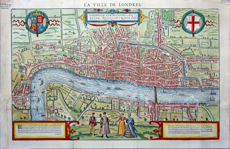
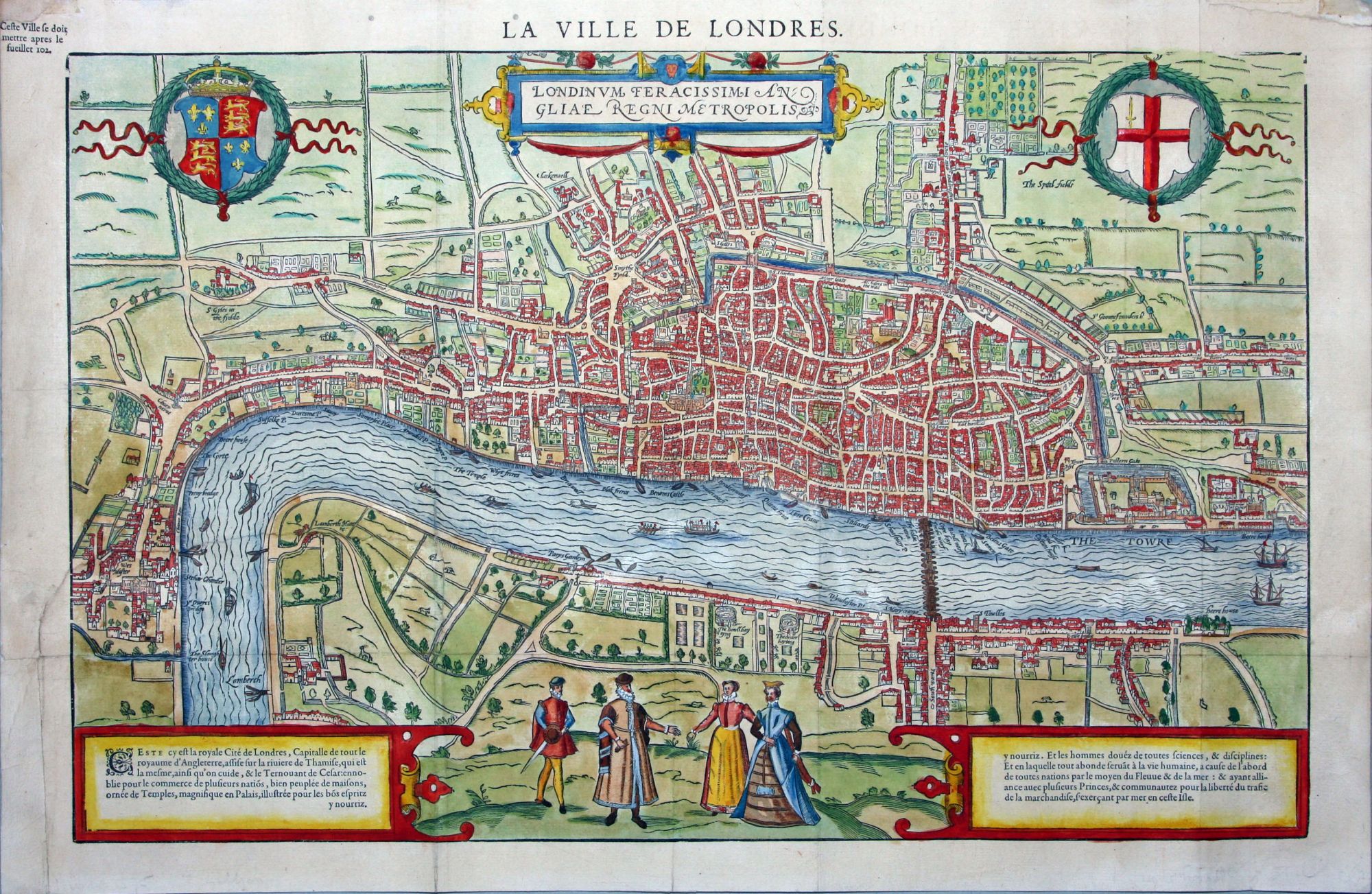
La Ville de Londres.
12½ x 18¾ inches. Fine hand color; mended tear at insertion point, reinforced with rice paper. Very good condition.
Rare, very attractive woodcut edition of the Braun & Hogenberg plan of London, the first detailed, single-sheet plan of the city. Howgego (p. 9) calls the Braun & Hogenberg one of the two “best known and most important of the surviving early map-views of London.” S. P. Marks suggests the plan shows the city as it was at some point between 1547 and 1559. The Tower and its fortification complex can be seen at lower right, and the original St. Paul’s Cathedral is clearly delineated in the center of the city. London Bridge is the only span in the plan traversing the Thames to Southwark, where two bear-baiting arenas can be seen. Four figures in dress of the period are depicted below the plan.
* Howgego, J. Printed Maps of London, no. 3.
Sold