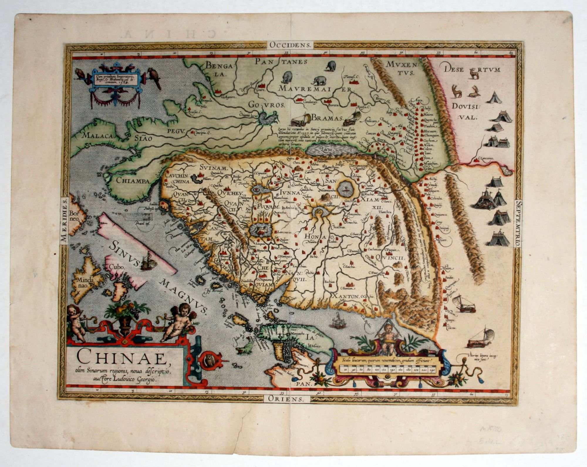
Chinae, olim Sinarum regionis, nova descriptio.
14 3/8 x 18 3/8 inches. Fine hand color; mended tear in bottom margin not entering engraved area, bottom of centerfold reinforced, else excellent condition.
The rare first issue of the earliest printed map specifically of China and “the first to show the Great Wall”—Nebenzahl. "This map remained the standard type for the interior of China for over sixty years" –Tooley. The first state of this map appeared only in editions of Ortelius' atlas from 1584 to 1587.
With its three lushly designed cartouches and many illustrations of indigenous shelters, modes of transportation and animals, this is one of Ortelius’s richest engravings. Just how early this map was in the West’s contact with China is suggested by the fact that Portuguese Jesuits were not allowed to establish a mission on Chinese soil until 1577, just seven years before the map was published. Although the map’s Portuguese maker, Barbuda, was himself not a Jesuit, his sources for the map were Portuguese Jesuits. The Chinese characters found in the text on the verso of the map were the first introduction to Chinese language for many educated Europeans of the time. The map and text would have forced many Europeans to see China for the first time as a nation and culture distinct from the others of Asia.
* Van den Broecke, Ortelius Atlas Maps, 1584L93, p. 492; Nebenzahl, K. Mapping the Silk Road and Beyond 4.6; Tooley, Maps and Mapmakers, p. 106, pl. 78 (p. 108); Walter, L. Japan A Cartographic Vision 11F, p. 186.
Sold