
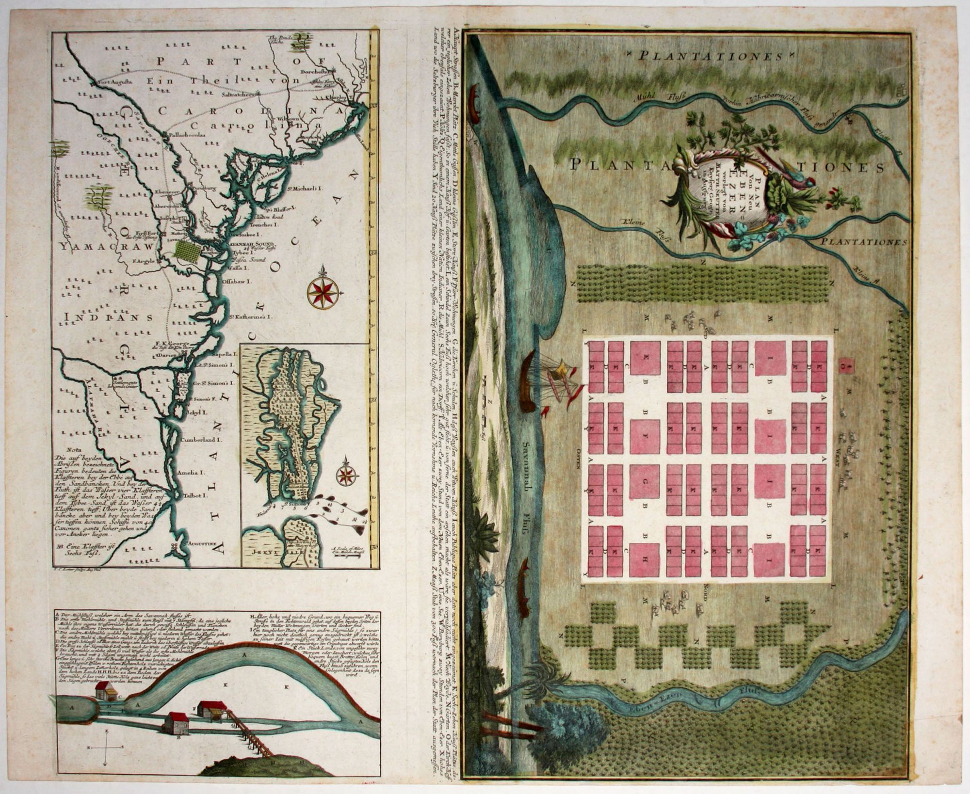
Plan Von Neu Eben=Ezer verlegt von Matth. Seutter.
22 3/4 x 19 5/8 inches, Fine original color; a fine, bright example.
A very rarely seen printed plan of a colonial settlement in Georgia. A beautifully engraved and colored example one of the relatively few surviving, early printed plans of a North American colony and an important document in the development of Georgia. The work's lush presentation of the settlement and the fact it was published in Germany, suggest that it was created to lure emigrants to Georgia. Further supporting this, as Cumming notes, the work was first published in a tract in 1747 and separately as a broadside as well. The plan is of a German settlement on the Savannah River and shows a highly regular design in a verdant setting. "That this ordered plan was partially executed is shown by the actual survey of Ebenezer taken about 1770 by De Brahm" (Cumming).
The accompanying, large inset map covers the Southeast from Charleston, South Carolina to St. Augustine, Florida. In addition to New Ebenezer, the map includes a street grid for Savannah and other German settlements. It also shows a road or trail connecting various locations in South Carolina and Georgia. A smaller inset within this one shows the channel between St. Simon's and Jekyl's islands. Also inset is an engraving of water mills.
* Cumming 265; Tooley, Mapping of America, no. 115, p. 211.
Sold