
Plan de Paris Commence l’Annee 1734.... Leve et Desine par Louis Bretez Grave par Claude Lucas / Et Ecrit par Aubin.
Large folio with 21 etched & engraved plates numbered 1-20, one of which folding, & 1 unnumbered key plate. Bound in modern mottled calf, gold-tooled raised bands on spine, title in gold on leather label inset in spine; plates on heavy stock, a few stains & some light hand soiling, fleurs-de-lis at corners of frame (sheets 1, 4, 17, 20) abraded, marginal mend on sheet 9 not affecting printed image, else excellent.
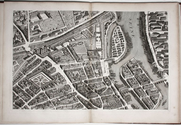
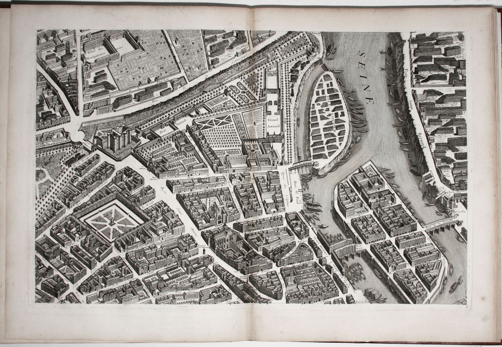
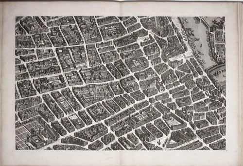
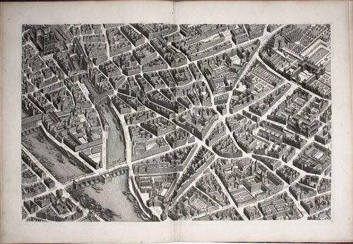
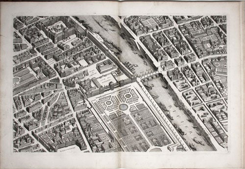
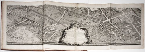
A bright, beautiful copy of one of the most ambitious and finely engraved works of urban cartography ever produced: it depicts every structure existing in Paris at the time. This remarkable engraving enables the viewer to virtually hover a few hundred feet above the city and take in the exquisite details of its architectural glories. This is the sole original edition of the plan that is composed of 20 sheets (plus a key sheet), which if assembled would form a mammoth wall map over 12 by 8 feet (316 x 245 centimeters). “Characteristic of engravings produced by royal command, the map, which is superbly engraved, is surrounded by an ornamental border containing the arms of Paris, with the same arms or fleurs-de-lys of France at the four corners”-- Baines, Millard Collection, 39. (In the present copy these fleurs-de-lys have been censored, apparently by a reader with anti-royalist sentiments.) In addition to having been the best representation of Paris to date, the plan is of great value to historians and archeologists today.
The Turgot/Bretez was the culmination of a series of plans of Paris produced during the late seventeenth and early eighteenth centuries. Especially remarkable is the plan’s perspective, representing the city's structures in three-dimensional quarter view, thus affording revealing looks not only of the city’s civic structures, churches, and private residences, but also of their inner courts and gardens. In addition, the plan is not oriented to the north in the conventional manner but to the east, so the viewer can see the portals of the city’s numerous churches, which customarily face to the west. Bretez, the actual maker of the plan (Turgot was the dedicatee), was allowed access to every dwelling in Paris in the preparation of this work.
* Boutier 219.
Sold