
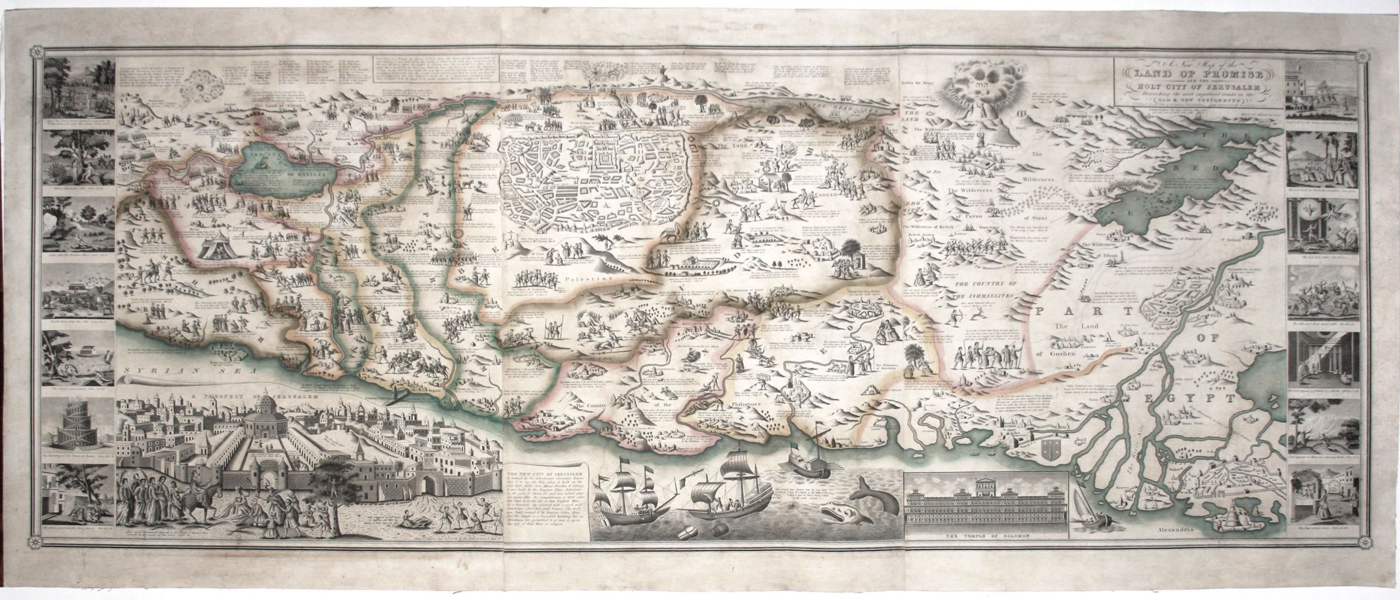
A New Map of the Land of Promis And The Holy City Of Jerusalem Describing the most important events.
22 1/2 x 57 1/2 inches, Three joined sheets, expertly mounted on new linen. Lithograph with attractive wash color; expertly conserved, occasional, relatively minor losses primarily in top area involving ms. replacement of some border work & text; overall good very good & visually highly appealing example.
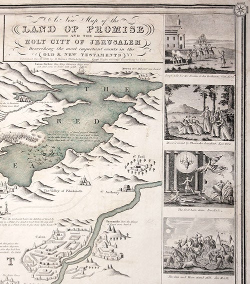
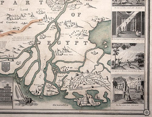
A very rare, visually rich, American-published wall map of the Holy Land and a part of Egypt. Its abundant imagery of primarily Old Testament episodes, with some of the New Testament intermingled, suggests the map was designed for Biblical studies by the young. This is born out by the naive quality of the engraving and the work's. Flanking the map are 14 larger vignettes illustrating Old Testament episodes in roughly chronological order, beginning at upper left and ending at lower right with an image of a Passover feast. At lower left is a large bird's eye view of Jerusalem; at top center is a plan of the Old Testament city; the story of Jonah is illustrated below right; and to the right of which is depicted Solomon's Temple. In Egypt are rudimentary street plans for Cairo and Alexandria. Nearly all the map's illustrations are accompanied by Biblical citations.
Remarkably, Haines map is the final version of a prototype that appeared nearly 200 years earlier--Jan van Doetechum the Younger's 1641 very rare Niewe Caertees das Lants von Beloften ende (Nebenzahl, Holy Land, pp. 120-121). This 1641 edition did not include the vignettes along the sides and other major illustrated elements. English versions of the map were issued by Overton (ca. 1717), Sayer (ca. 1752), Cluer Dicey (ca. 1765), G. Thompson (1795), among others throughout the 18th century. The first American edition was published by Thomas Duffield in Philadelphia in 1823 and was followed by the present final edition. Despite the number of editions, all are rare. We are aware of only two institutional examples of this Haines edition (Buffalo & Erie Country Public Library and the Harold Osher Collection) and only two sales records (High Ridge Books, 1992 and Heritage Map Museum, 1996). Furthermore, we noted only one example of the 1823 Duffield edition (Boston Public Library).
D. Haines was a Philadelphia engraver and "script writer" for several mapmakers, including J. H. Young, H. Tanner, and S. Augustus Mitchell, all of Philadelphia. This is the only map published under his own imprint that we are aware of.
* Tooley's Dictionary of Mapmakers, E-J, p. 247; not in Laor.
Sold