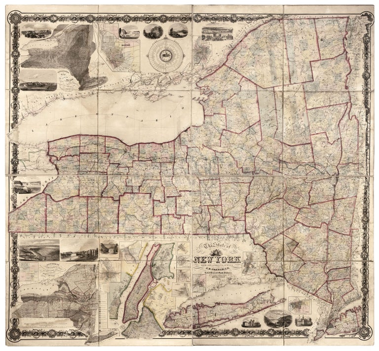
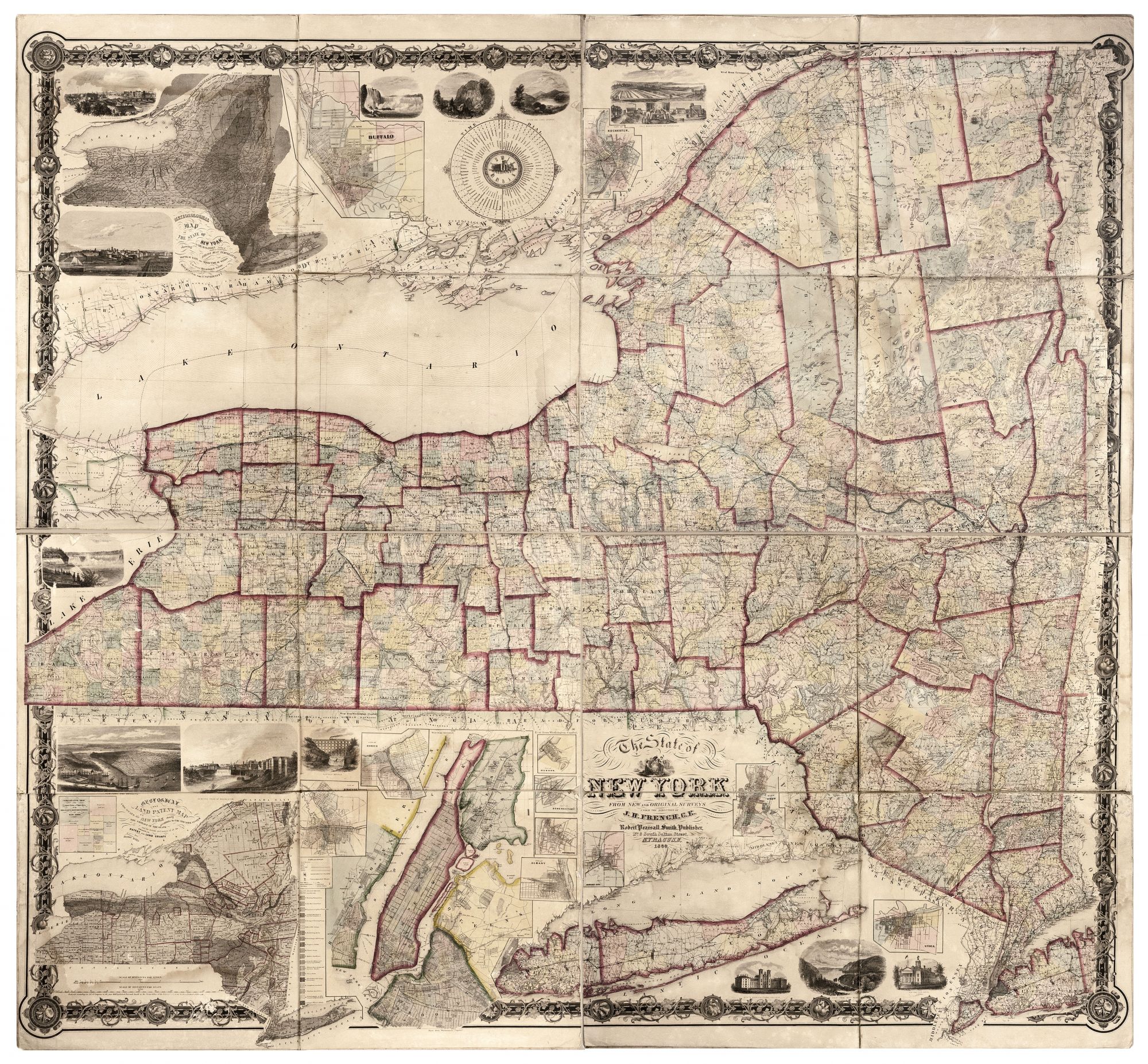
The State of New York from New and Original Surveys under the direction of J.H. French.
67 x 72 inches; folds to 17 x 18 inches, Hand-colored lithographed, folding wall map, dissected & mounted on linen as issued, with marbled paper covering top & bottom sections when folded. Some chipping at sheet edges, minor light staining, overall excellent for this work. A breathtakingly ambitious map both in scale and content, pronounced by Ristow as being of "higher quality than the maps of other states published prior to the Civil War." Ristow in fact devoted an entire chapter to its creation; see below. Fortunately, the map is here offered in folding form, making its massive size manageable--it folds to a size of 17 by 18 inches. Also, so formatted, it did not experience exposure to the elements as would have the much more common, wall-map examples. The work includes inset plans of twelve of the state's cities, among them, of course, the New York metro area that includes Brooklyn, the Bronx and Queens, as well as of Rochester, Troy, Schenectady, Syracuse and Buffalo. Queens and the Bronx are seen in the early stages of their development, while Brooklyn is already completely networked with street grids. There are also 13 pictorial vignettes, including ones of Lake George, "Adirondack or Indian Pass," two of Niagara Falls, Buffalo Harbor, and a fine bird's-eye view of New York City and Brooklyn. There are two large, thematic, inset maps of New York State--one delineating its climate, and the other plotting both its geology and the original land grants with the names of the holders of these. Beginning in 1853, Robert Pearsall Smith contracted with several local surveyors to construct maps of New York's counties, and in 1855 he engaged John Homer French to compile a state map from these. Although the individual county maps were not of uniform quality, they were far more consistent and comprehensive than the local surveys conducted for any other American state at the time. The resulting map was first published in 1859 (our example being the second edition); it supplanted Burr's Atlas of the State of New York (1829), in providing the definitive mapping of the state. It retained this status for two decades, when the U.S. Geological Survey began publishing maps based on original triangulation. Despite the quality of the French's map, the number of copies sold was insufficient to offset costs, and in 1865 Smith sold his publication rights to H. H. Lloyd, who brought out new editions. Cf. BMC Printed Maps X, col. 558; Journal of the American Geographical and Statistical Society 2 (1860), p. 135; Phillips, America, p. 513; Ristow, American Maps & Mapmakers, pp.355-78; Rumsey 0934.
Sold