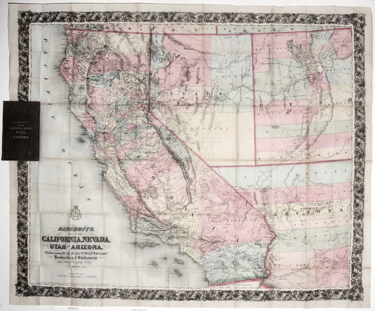
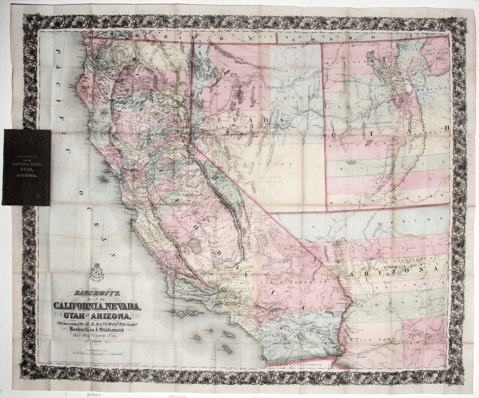
Bancroft's Map of California, Nevada, Utah and Arizona.
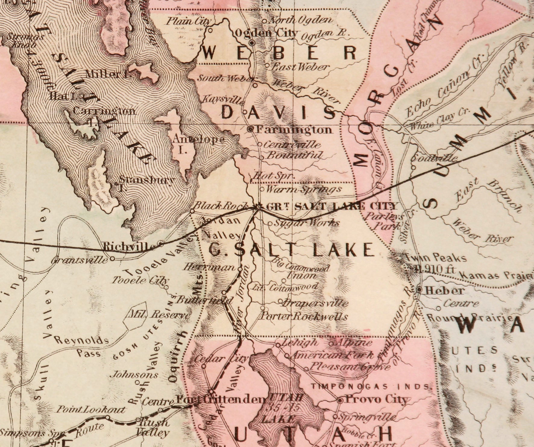
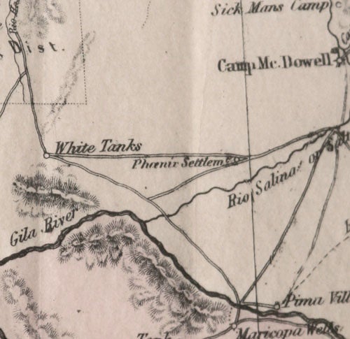
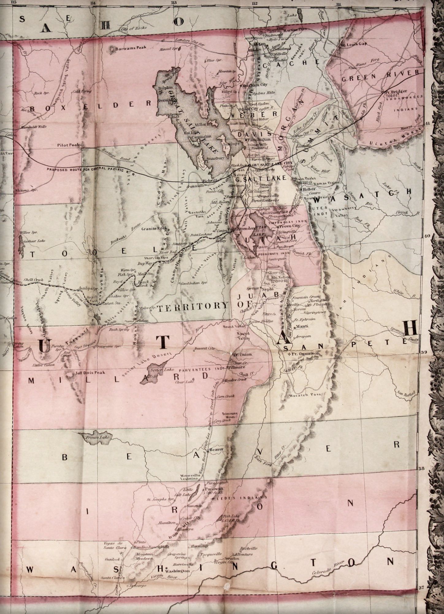
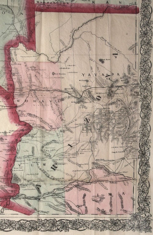
27 1/2 x 33 3/4 inches, Lithograph with full, original hand color folded into its contemporary stamped cloth covers embossed on front cover with title. Slight fold wear, else a fine, bright example. The scarce first edition, in a fine, vibrant, fresh example. This map was an early iteration of what Wheat called "the great 'map of the Pacific states" by William H. Knight published in 1863, also by the Bancroft firm. Its many offspring established Bancroft as "the greatest map publisher of the Pacific Coast" (Wheat). Wheat further observed of these maps: "So large in size are these maps and so overflowing with detail, it is utterly impossible to describe their minutiae." The map is particularly rich and interesting in the various types of transportation routes to be found. The "Overland Mail Route" is shown connecting Salt Lake City and Placerville, California, with all of its stops noted and identified. As something of an image of what could have been, numerous rail lines traverse California on the map, though most are proposed rather than than existing. Many of the former were planned to connect the northern and southern parts of the state. The proposed route of the Central Pacific portion of the transcontinental railroad, which would not be completed until 1869, is shown south of the Great Salt Lake rather than along its eventual, more northward path. "Wagon Roads" are shown, including the very long one from Salt Lake City to Los Angeles. The map notes various natural features (buttes, craters, springs, etc.), mining districts, rivers large and small, and topographic features. Despite its relatively large scale, the density of information on it, in California at least, is truly remarkable. Wheat, Transmissippi West, no. 1093, pp. 104-106; Rumsey 4820.
Price: $3,500.00