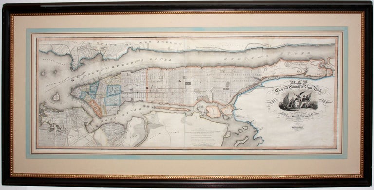
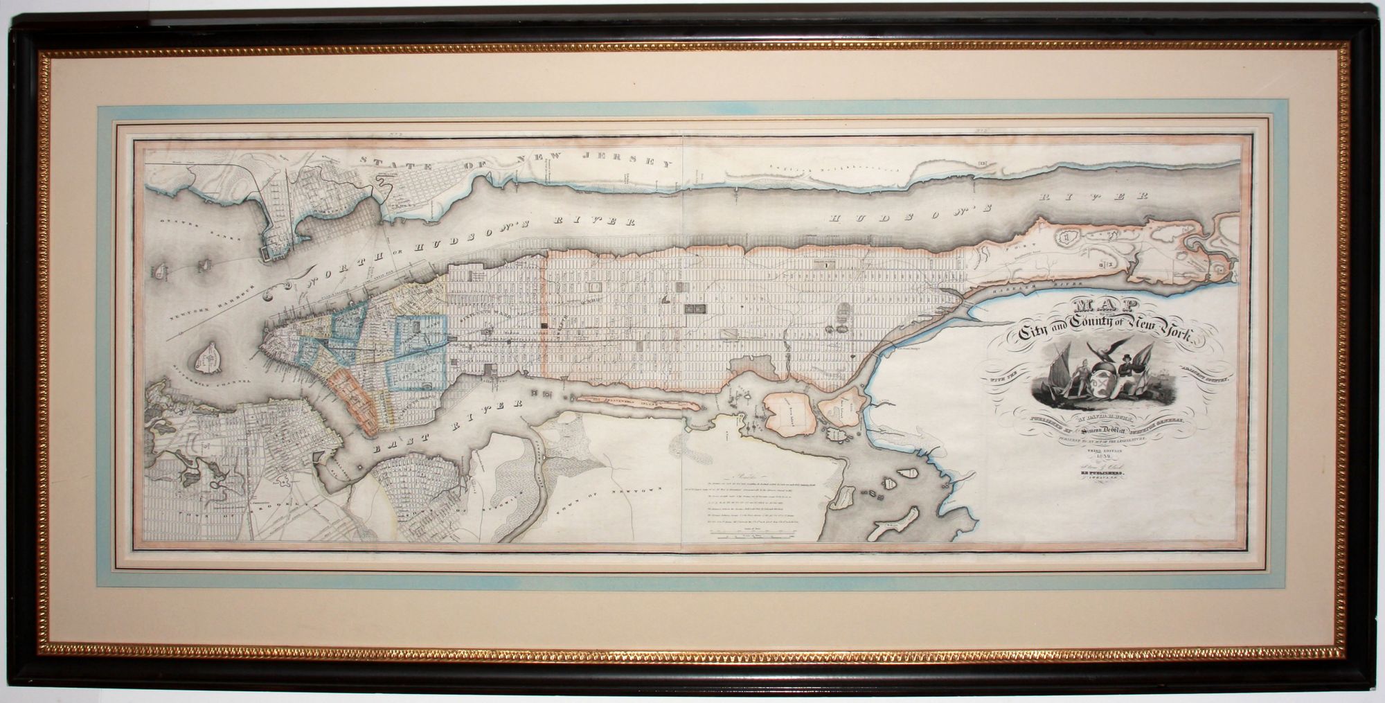
Map of the City and County of New York.
19 ½ x 49 ½ inches, Original outline color; overall a very fresh, excellent example. Archivally framed.
Large, richly detailed, extensively updated iteration of one of the finest plans of New York City of the first half of the 19th century. This third edition added a wealth of detail both within the bounds of New York City and beyond its borders. The Harlem Rail Road has been added running the length of Fourth Avenue and down the Bowery; a lunatic asylum and its grounds are marked in the upper West Side; and the site of a prospective asylum is shown on Blackwell’s Island. Political boundaries have been updated with the addition of three wards; the ninth, eleventh and twelfth wards were divided to keep pace with a sharp increase in development from Houston Street up to 42nd Street. Planned growth is also addressed: extensive bulk-lines have been added to indicate future landfill along the shorelines, and city grids replace countryside in many areas. In Brooklyn, the Williamsburg grid now extends into Bushwick, while the developed part of the city fills the corner of the map, where before it had ended at Fort Greene. Across the Hudson, Jersey City’s grid has expanded to include Hoboken.
This map appeared in the third edition of Burr’s An Atlas Of The State of New York, which was the second American state atlas.
* cf Augustyn & Cohen, Manhattan in Maps, pp 120-121.
Sold