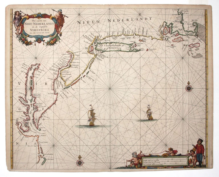
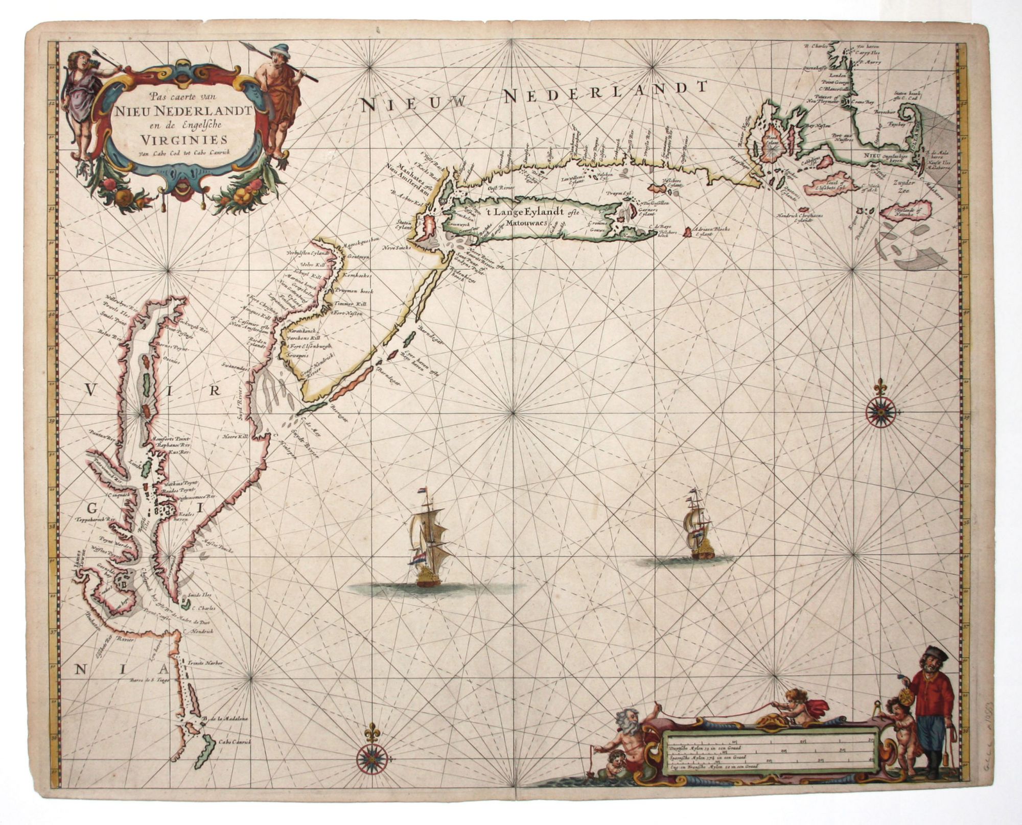
Pas caerte van Nieu Nederlandt en de Engelsche Virginies.
16 3/4 x 20 ½ inches, Fine original color, refreshed, on heavy, double-ply paper; lightly toned, else excellent.
One of the most beautiful early charts of southern New England and the mid-Atlantic region. Some of the finest artistry of Dutch cartography is found on sea charts. The most successful publisher in this field was Pieter Goos, whose work was popular with both the practicing and armchair sailor. His chart of the Northeast presents the elements that makes his work so highly desirable: excellent balance between embellishment and map; realistic maritime detail, such as the sailor holding a navigational instrument, mingled with baroque decoration; rich color; and fine paper.
Although Goos is reputed to have been a derivative mapmaker, this particular chart was based on independent sources via the 1661 van Loon chart. The shapes of both Manhattan and Long Island are well rendered (compare with Van Keulen's 1684 chart) as is the New Jersey shore and Delaware Bay and River. Along the latter, all of the Swedish and Dutch forts and settlements are shown. Many original Dutch place names have been retained throughout these areas. However, early English settlements appear along the Connecticut shore (Gilfort, Stamfort, Stratfort, Milfort, etc) and on Long Island (Hampton and Garners (Gardiner’s) Eylant.
* Burden 387; Deak, G.G. Picturing America, no. 48.
Price: $10,500.00