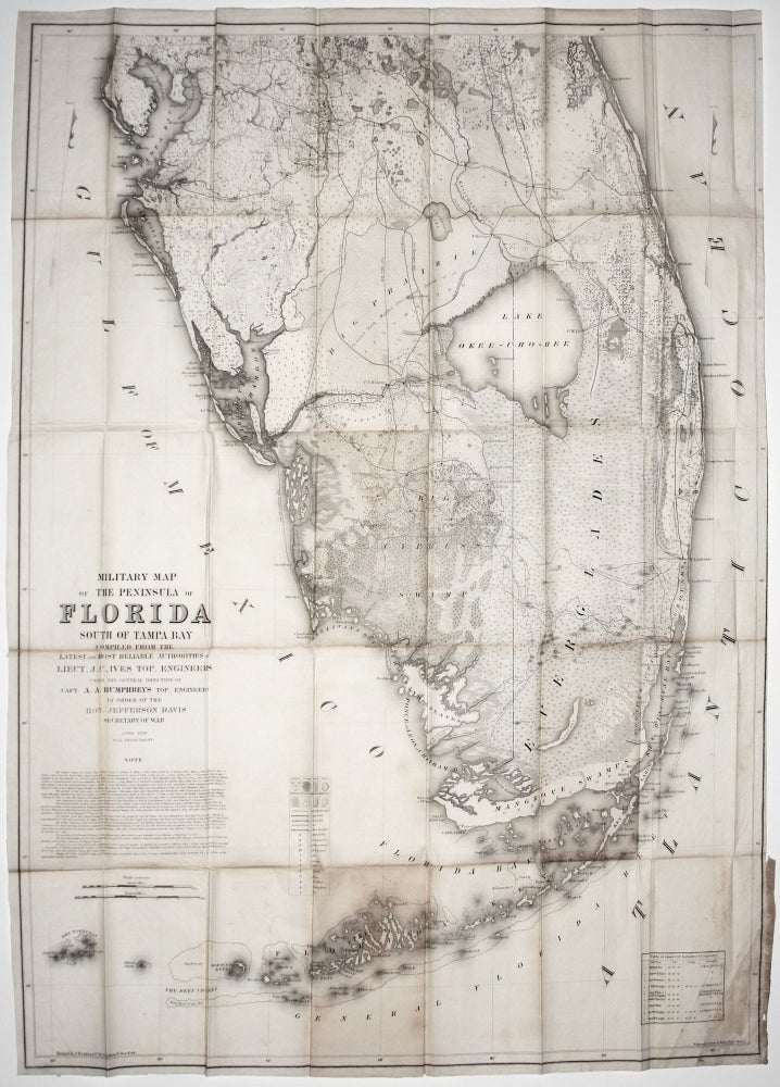
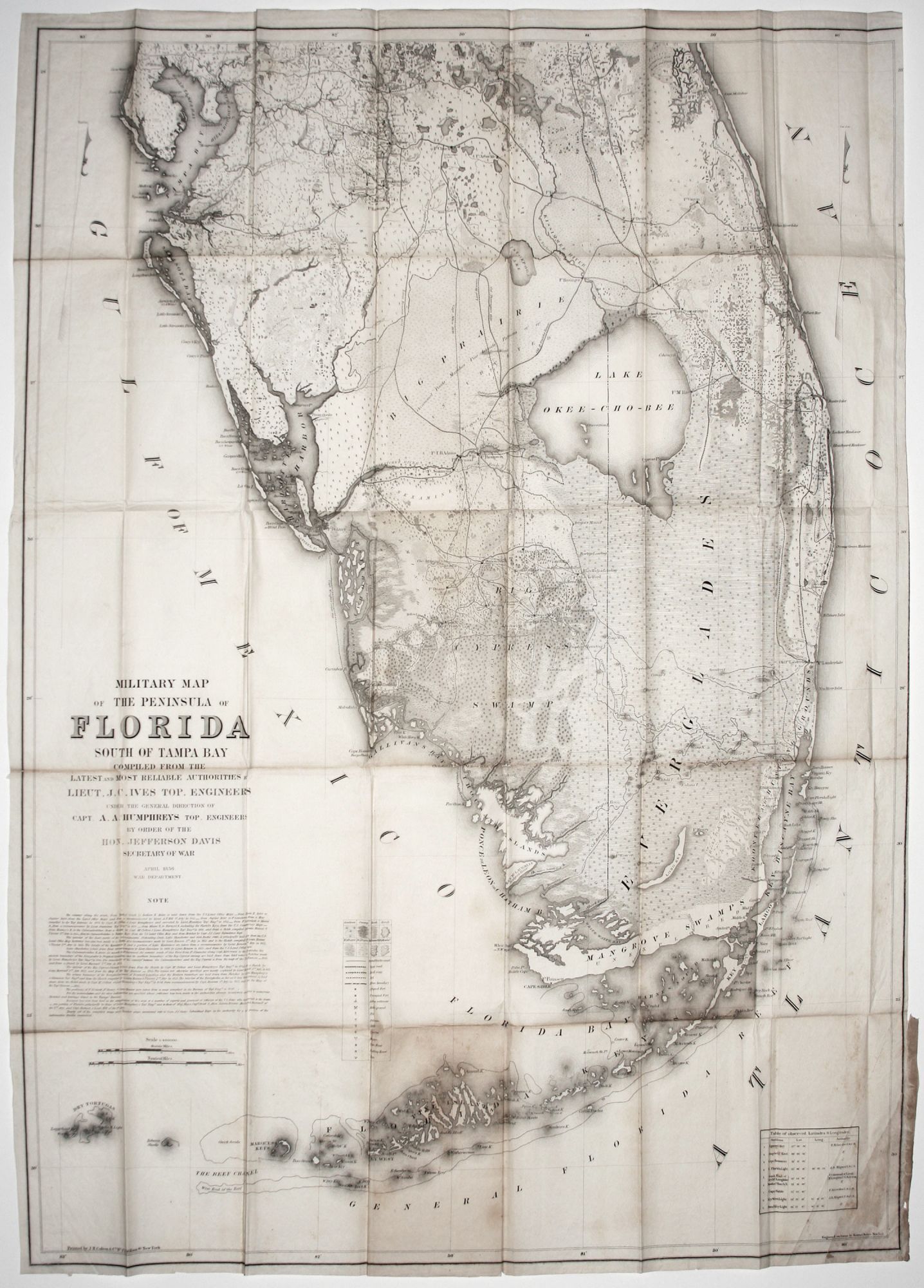
Military Map of The Peninsula of Florida South Of Tampa Bay…By Order Of The Hon Jefferson Davis Secretary of War April 1856….
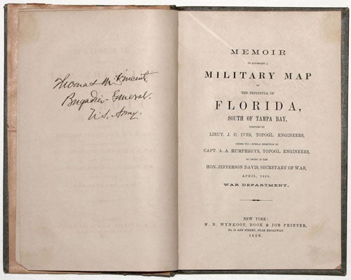
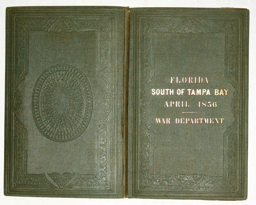
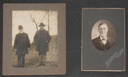
42 ½ x 33 inches, Lithographed folding map. [Bound with:] 42 pp. Memoir to accompany a Military Map of The Penisnusa Of Florida,…New York:…1856. Signed opposite title page: “Thomas M. Vincent, Brigadier-General, U. S. Army.” [With:] Two dated photographs of Vincent, one with General McCook. Bound in original green linen, elegantly embossed, over boards with title in gold lettering on front cover; light fold wear discoloration, mend to lower right corner; overall very good.
Very rare—only a 1911 reprint recorded in catalogues over the last 25 years; no copies recorded at auction. Signed by General Thomas McCurdy Vincent (1832-1909), an officer who saw long and important service prior, during and after the Civil War.
This was the first map to compile disparate military and government surveys of the southern part of the Florida peninsula into a single, coherent, useful map. No previous map approached the level of detail for southern Florida that is found on this one. Despite the long presence of the American military in Florida in the first half of the 19th century during the Seminole Wars, much of the Florida peninsula in the mid 19th century remained one of, if not the most poorly mapped areas in the eastern United States. As Ives points out in the introduction to his Memoir, existing military surveys varied widely in quality, as many were made under conditions not permitting great accuracy. This combined with the fact that they were never woven together into a general map rendered them almost useless. Ives therefore culled out the best military surveys and collated them together with U. S. Land Office maps and U. S. Coast Survey charts to produce this map. Some source materials for the map were furnished by this work’s signee, General Vincent, who is cited by name in the Note enumerating the map’s sources.
A primary goal of this map—and one that again bespeaks the truly rudimentary extent of the mapping of Florida at the time—was to identify viable routes between military installations. The map differentiates between “Wagon Roads,” Blazed Trails,” and “Trails.” These are shown plainly and are combined with the routes of various military, exploring expeditions, which, as Ives points out in his Memoir, were at risk of being forgotten if not set down on a general map.
Ives’s map also attempts to delineate the topography of Florida in more detail than previous maps. Eight different types of land surface, from swamp to sow grass, are illustrated on the map. Ives is quick to point out that these are all subject to change given Florida’s low-lying, wet conditions. Various types of forest are identified, and the locations of battlegrounds, forts (both occupied and not), Indian settlements, towns and dwellings. Curiously, since the map was published in April of 1856, it notes a battle was fought on March 29, 1856 near the Wahika Inlet and just south of Marco Island and Gallivan Bay along the lower west coast.
The map was produced by the order of Jefferson Davis, then Secretary of War. Interestingly, the New York-born Ives ended up fighting for the Confederacy during the Civil War, even declining a captaincy in the U. S. Army to do so. He was on Davis’s personal staff and was the chief engineer for the defense of southeast coastline. Perhaps Ives’s loyalty to Davis was forged in the production of this map. Another Civil War connection in the map is that some of surveys Ives worked with had been conducted by then Captain McClellan.
Although this work has the look of an official or government publication, it appears to have been a private publication, perhaps one intended for a very limited, professional readership. This could explain its great rarity. It was published by M. B. Wynkoop, Book & Job Printer, and printed (not published) by J. H. Colton & Co., the important map publishing house.
Vincent’s career was of the type that is easy to overlook and undervalue, as it was largely spent in what can inadequately be termed an administrative capacity. After graduation from West Point in 1853, he did see three years combat duty in the Florida Seminole Wars. While convalescing from illness incurred during this time, he authored “A Sketch of Southern Florida,” which was furnished to troops on duty there. Although he fought at Bull Run, he spent the remainder of the Civil War in the Adjutant General Office. He played a central role in the raising and organization of the Union’s vast volunteer army. At the end of the war he was the sole author of the plan for the demobilization of an army of over a million soldiers. He is buried with his wife, Laura Lancaster Vincent, at Arlington National Cemetary.
Joseph Christmas Ives (1828-1868) graduated from the U. S. Military Academy in 1828 and is best remembered for his surveys and descriptions of the Colorado River (“Report Upon the Colorado River of the West”), resulting from an expedition he headed in 1857-58.
* Tooley’s Dictionary of Mapmakers, Revised Ed. E-J, p. 414; Dictionary of American Biography 9, pp. 520-21.
Sold