Two Sheets: Parts Of Western Wyoming And Southeastern Idaho.
with: Panoramic Views.
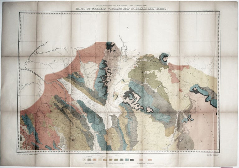
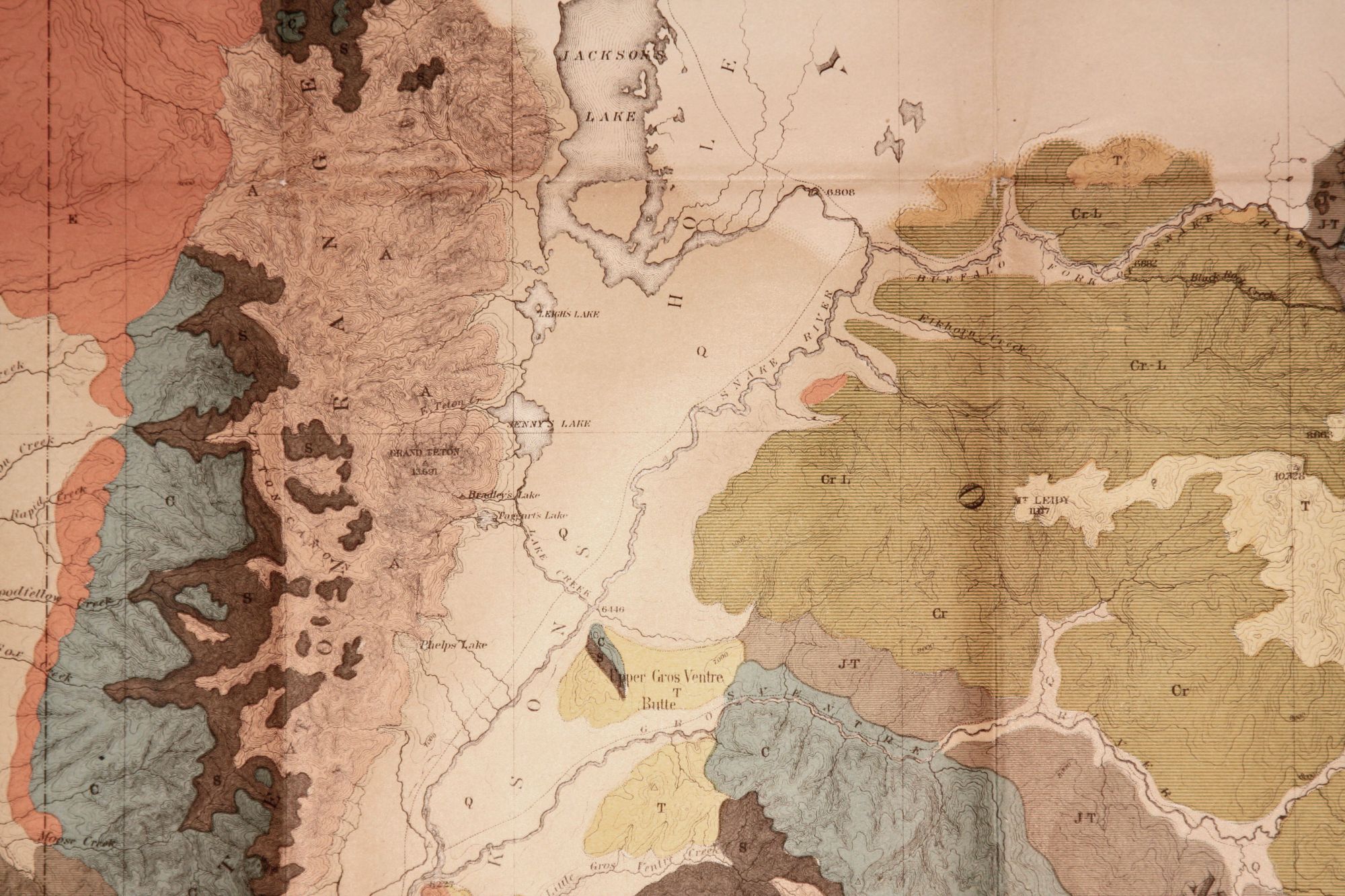
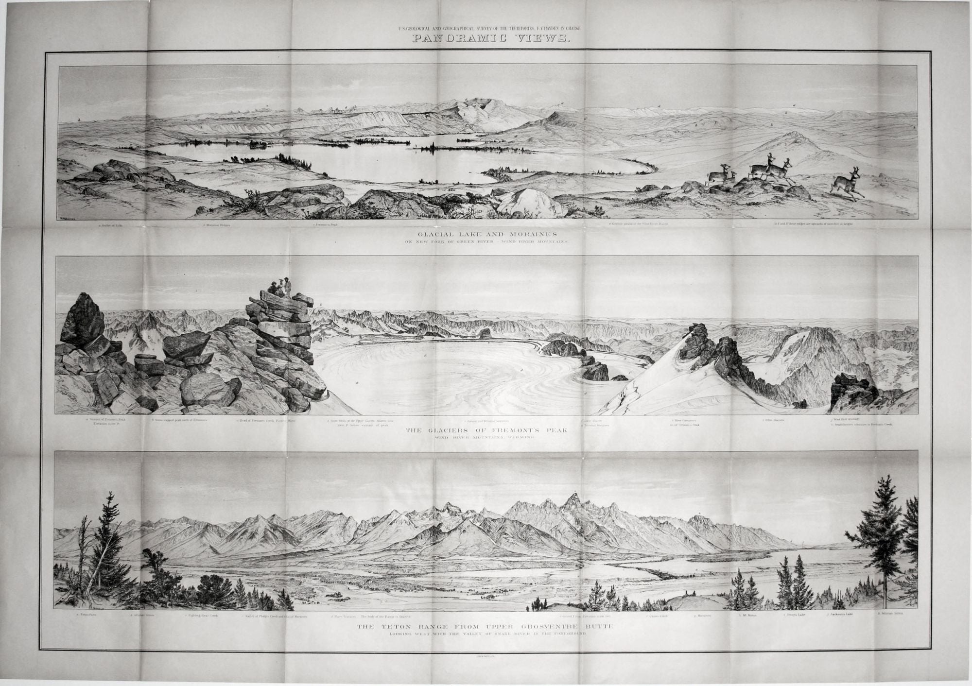
Two Sheets: 25 ¼ x 32 ¾ inches. Parts Of Western Wyoming And Southeastern Idaho. Chromlithograph. Minor fold wear & toning, else excellent condition with bright colors. Panoramic Views. 24 ¼ x 34 ¾ inches. Lithograph with light sepia tone. Minor fold wear & toning, else excellent condition.
Two striking, large-scale sheets from Hayden’s The U. S. Geological and Geographic Survey of the Territory, Embraced by Idaho and Wymong... and based on surveys conducted in 1877 and 1878. With its vivid colors, the map shows the various type of geology found in primarily southeastern Wyoming. On the map, Jackson Lake and the Teton Range appear at top center. The bottom of the three views shows the Teton Range from Jackson Lake to Teton Pass. The center view entitled “The Glaciers of Fremont’s Peak” depicts a party of surveyors atop a rock formation. The top view—“Glacial Lake And Moraines On New Fork Of Green River-Wind River Mountains”—captures the serenity of a mountain lake and has a small herd of elk to the right.
Sold