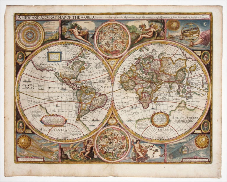
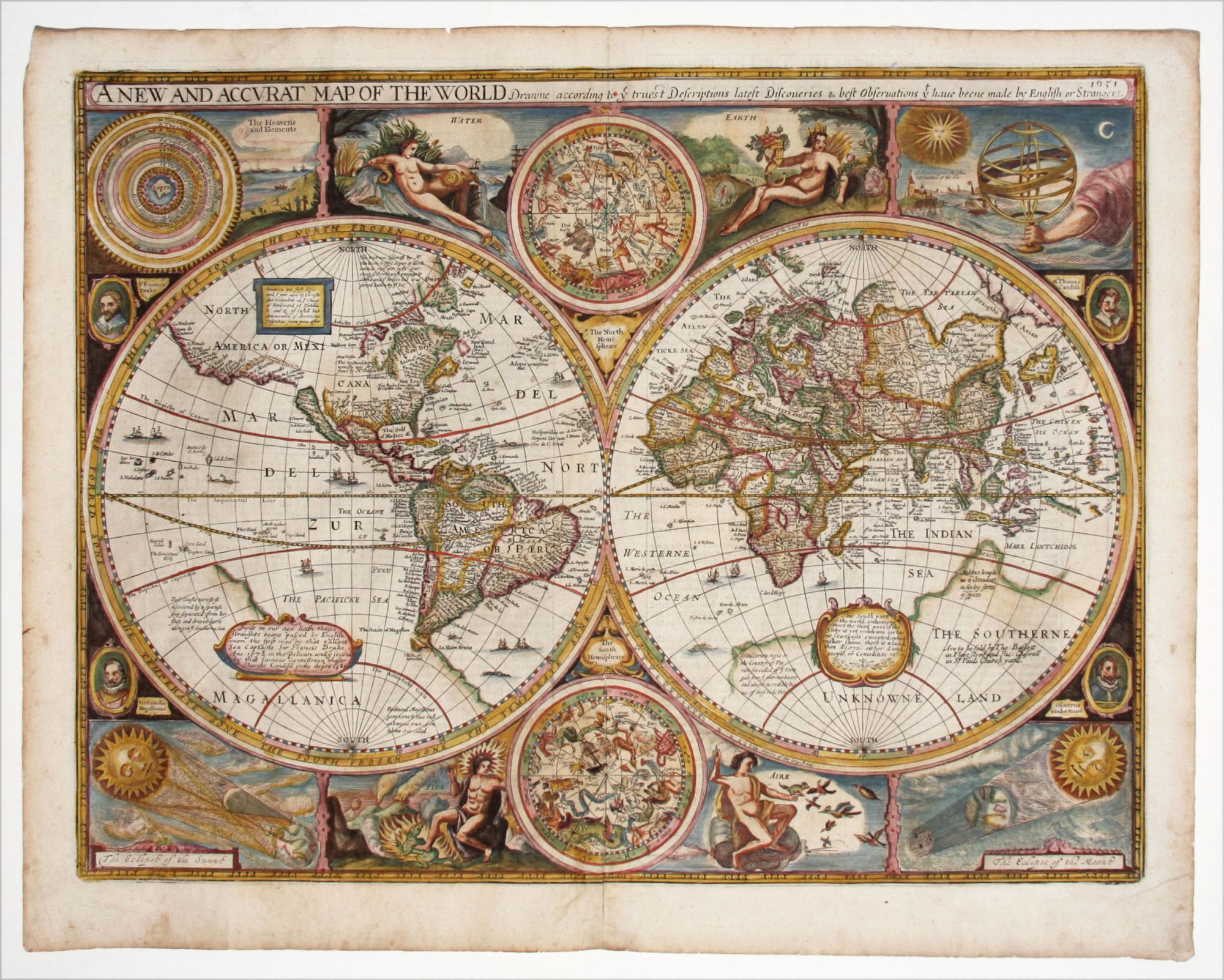
A New And Accurat Map Of The World.
15 ½ x 20 ½ inches, Fine hand color; reinforced lower centerfold, else excellent condition.
One of the most desirable, early world maps is John Speed's, which appeared in the first English world atlas. It is more difficult to find than the Dutch world maps of the period because, as Shirley explains, Speed's atlas had little circulation outside of England. The map is also notable as the earliest world map to show California as an island.
The map provides a decidedly Anglicized slant to the discovery and exploration of the New World. In a note in the United States, John Smith is erroneously called the discoverer of New England. The Atlantic Ocean along the eastern seaboard of the United States is called the Virginian Sea, a rare instance of this usage. Elsewhere, the achievements of Hudson, Davis, Drake, and Cavendish are noted.
In its vigorous presentation, Speed's map provides the kind of lavish display ordinarily just found on Dutch world maps of the period. Included on it are portraits of explorers, including Drake and Magellan, two star charts, symbols for the elements, and depictions of various natural phenomena.
There are several very interesting notes in the great Southern Continent, which provide a good idea of what was believed at the time concerning this vast, hypothetical land mass. One in the South Pacific says that this part of the Southern Continent was discovered by Spanish ships that had been blown off course.
* Shirley 317; Portraits of the World, Sheldon Memorial Art Gallery (Univ. of Nebraska), #43.
Sold