Laurie's Genaral Chart Of The Coasts Of Brasil, &c. From The River Para To Buenos-Ayers;.
38 1/4 x 75 1/4 inches, 3 joined lithographed sheets mounted on linen as issued, with numerous harbor details pasted-on; backing linen folded over onto recto obscuring outer engraved border in a few areas, relatively small amount of staining & creasing, a split, but a remarkably bright, well-preserved example of a chart that had clearly seen onboard-ship use.
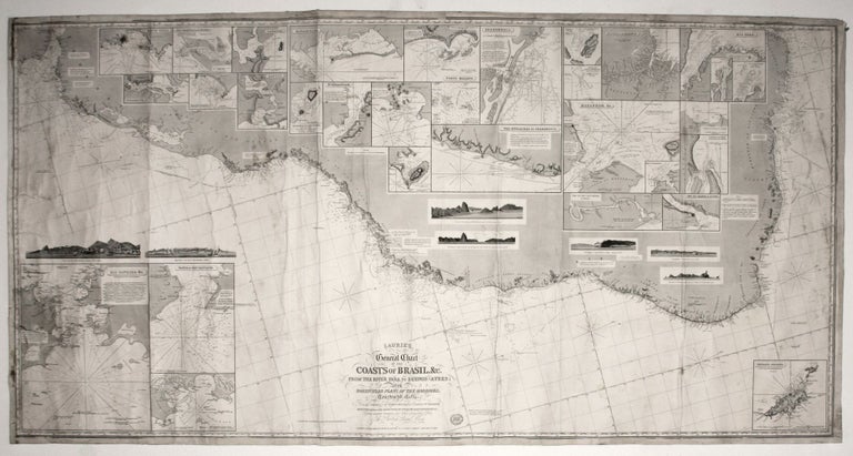
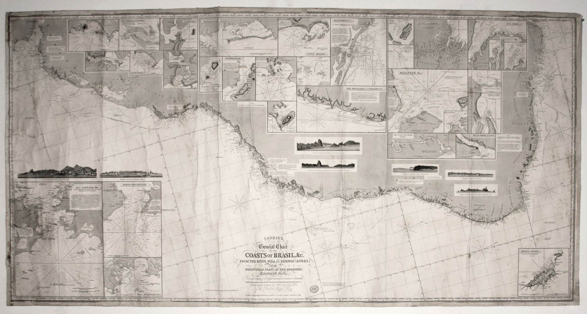
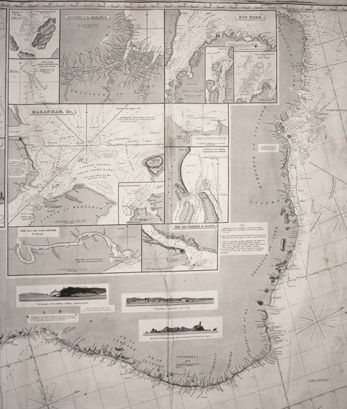
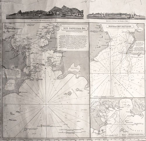
Very scarce (one OCLC location--Rumsey Collection at Stanford). An exceptionally fine production of English nautical cartography, this beautifully executed chart of the coast of Brazil is supplemented by 30 insets of harbor charts of varying scales and seven profile views that include views of the cities of Rio de Janeiro and Bahia. And while this example of the chart obviously saw ship-board use, it is a remarkably bright, relatively unmarred example.
This chart is a good example of the high level of quality required for private chart producers to remain viable in England in the second half of the 19th century. One of its notable features is that all of the harbor insets were pasted on, which would have allowed for a degree of customization. Robinson explains the challenge faced by commercial chart publishers when this work was issued: "The charts published each year [by the Laurie firm] steadily decreased, for Laurie in common with the few private chart publishers left in London, found it increasingly difficult to compete with the Admiralty chart...
Richard Holmes Laurie (1777-1858), son of Robert Laurie, joined the firm as a partner in 1812 and took over the company in 1818 with the death of James Whittle. "Laurie's own personal interest was in hydrography, and working with John Purdy, Alexander Findlay and Alexander George Findlay he successfully guided the business towards the compilation and publication of specialised nautical publications and charts (Tooley's Dictionary). Laurie's name was so highly regarded in the chart trade that the company continued under his name after his death in 1858 until 1903. The earliest edition we've seen of the present chart is 1847 (without Laurie's name as the first word in the title). The title of the present edition states that the chart was updated at some point.
* cf. Rumsey 5493.000; A. H. W. Robinson, Marine Cartography in Britain, pp. 123-124; Tooley Dictionary of Mapmakers, K-P, p. 97.
Sold