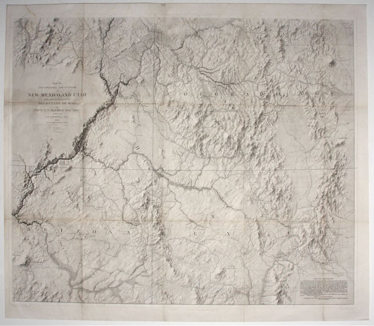
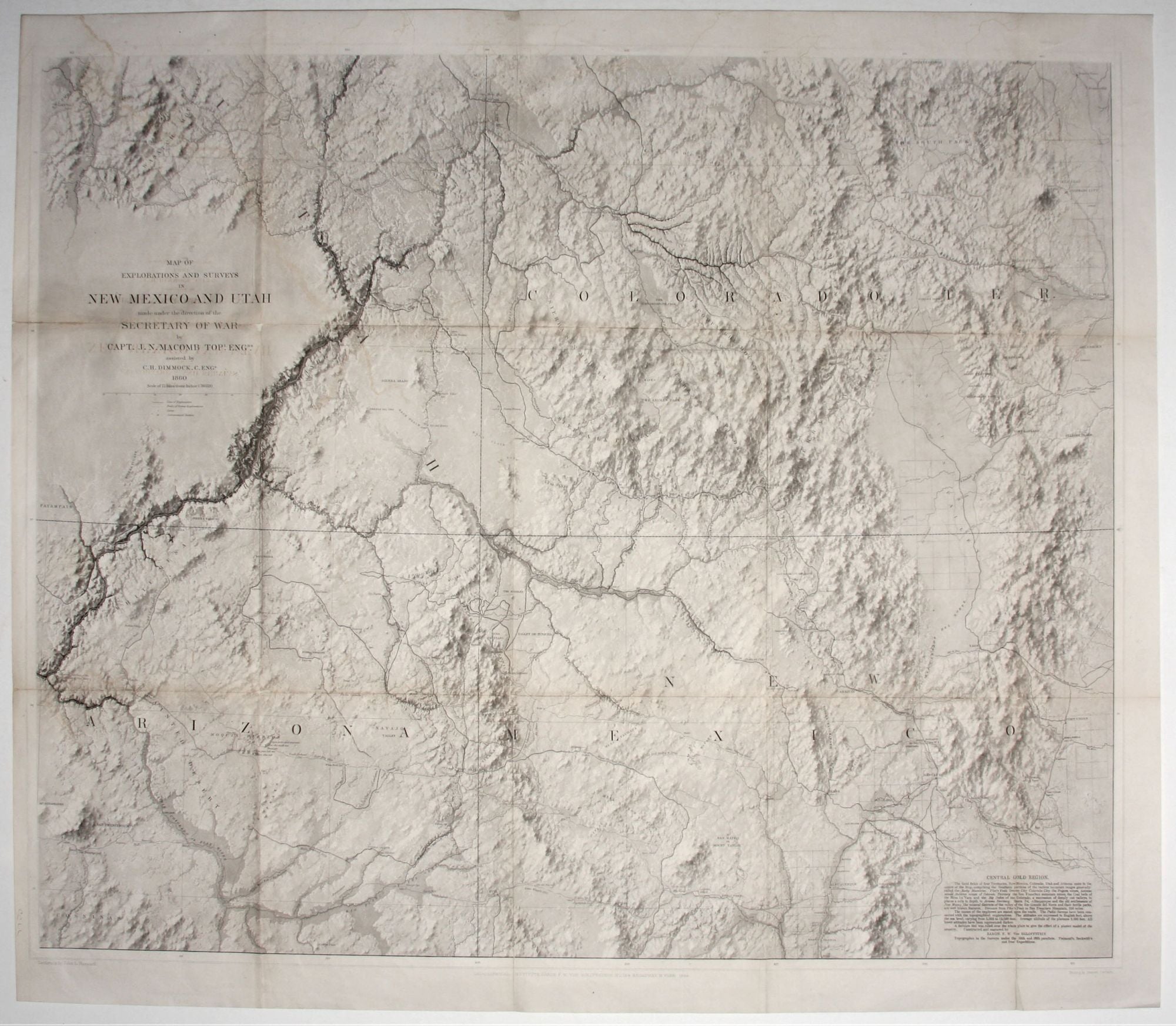
Map of Explorations And Surveys In New Mexico And Utah….
28 ½ x 34 in. Lithograph. Some folds reinforced, slight loss at a fold intersection, overall excellent condition.
An unusually well-preserved example of a work hailed by Wheat as "one of the most beautiful maps every published by the Army." It is, moreover, one those rare maps whose geographic import matches its exceptional aesthetics. This “landmark map for various regions” (Wheat) was the first to display Macomb’s discovery that the Colorado was a single, continuous river north of the Grand Canyon as opposed being in this area two distinct rivers—the Grand and the Green—as had been previously thought. The map is also an invaluable repository of the routes of the explorations of the period in the area, both well and lesser known; in addition to Macomb’s own route, those of Gunnison, Ives, Marcy, Father Escalante, Major Simonson, Fremont, and several others are included. Earlier Spanish trails, Indian habitations, and archeological sites are also shown. A note at lower right describes the gold regions to be found on the map.
As remarkable as any feature of the map is its evocation of topographic three-dimensionality more subtle and realistic than almost virtually anything previously seen on a printed map. The self-styled, “Topographer to the Surveys,” Baron R. W. Von Egloffstein, states that on the map“a delicate tint was ruled over the whole plate to give the effect of a plaster model of the country.” However, the process was much more complex than suggested here, involving the application of acid to the plate for varying amounts of time until the desired effect was achieved. This being the case, it can be said that in the hands of Baron Von Egloffstein the craft of creating a printed map became an art form. It is no wonder, therefore, that precious few maps were ever produced using this method.
The map was issued in Macomb's rare Report of the Exploring Expedition from Santa Fe, New Mexico, to the Junction of the Grand and Green River, the text of which was produced in 1860 (the map not until 1864) and both not issued until 1876 due to the Civil War.
* Wheat (TMW) #983; Goetzmann, p. 396.
Sold