![Item #10329 A New And Complete Rail Road Map Of The United States…[With smaller map attached lower left:] Rail Road Map Of Massachusetts Connecticut…. William PERRIS.](https://martayanlan.cdn.bibliopolis.com/pictures/10329.jpg?width=768&height=1000&fit=bounds&auto=webp&v=1508790311)
![A New And Complete Rail Road Map Of The United States…[With smaller map attached lower left:] Rail Road Map Of Massachusetts Connecticut…](https://martayanlan.cdn.bibliopolis.com/pictures/10329_2.jpg?auto=webp&v=1508790311)
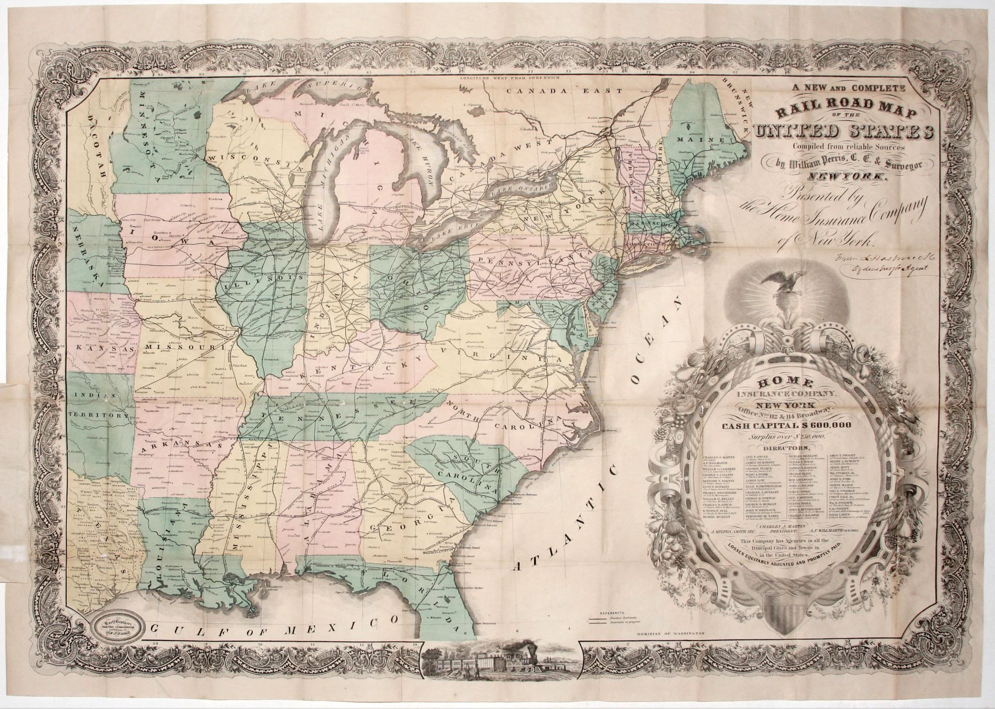
A New And Complete Rail Road Map Of The United States…[With smaller map attached lower left:] Rail Road Map Of Massachusetts Connecticut….
33 7/8 x 24 inches, Lithograph with original, full wash hand color; period ms. presentation inscription below title; some fold reinforcements with slight losses, still excellent of this type.
Rare, elegantly lithographed example of a map serving as a promotional device for a business--the Home Insurance Company of New York. The map displays both completed railroads and those in progress throughout the United States to somewhat west of the Mississippi and including part of Texas. Immediately apparent in this map published just prior to the Civil War is the considerably greater density of rail lines in the Northeast and Midwest as opposed to the South. A small map appended to the larger one details the rail lines of lower New England. Much of the non-map area is occupied by a grand cartouche framing information concerning the abovementioned insurance company. The names of the company’s directors are listed here along with their business affiliations; among them are a number of titans of business of the day. There is a handsome image of a locomotive and train at lower center, and a richly ornamental border surrounds the map.
* Modelski, A. Railroad Maps of the United States, no. 35.
Sold