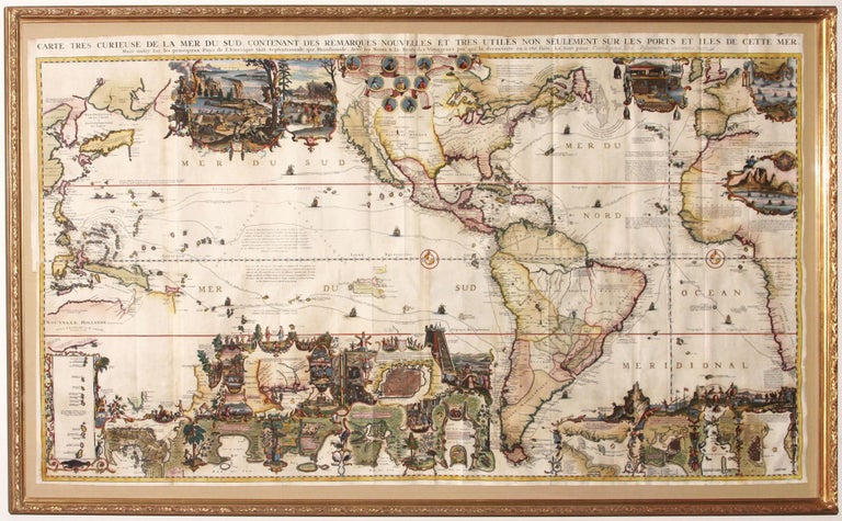
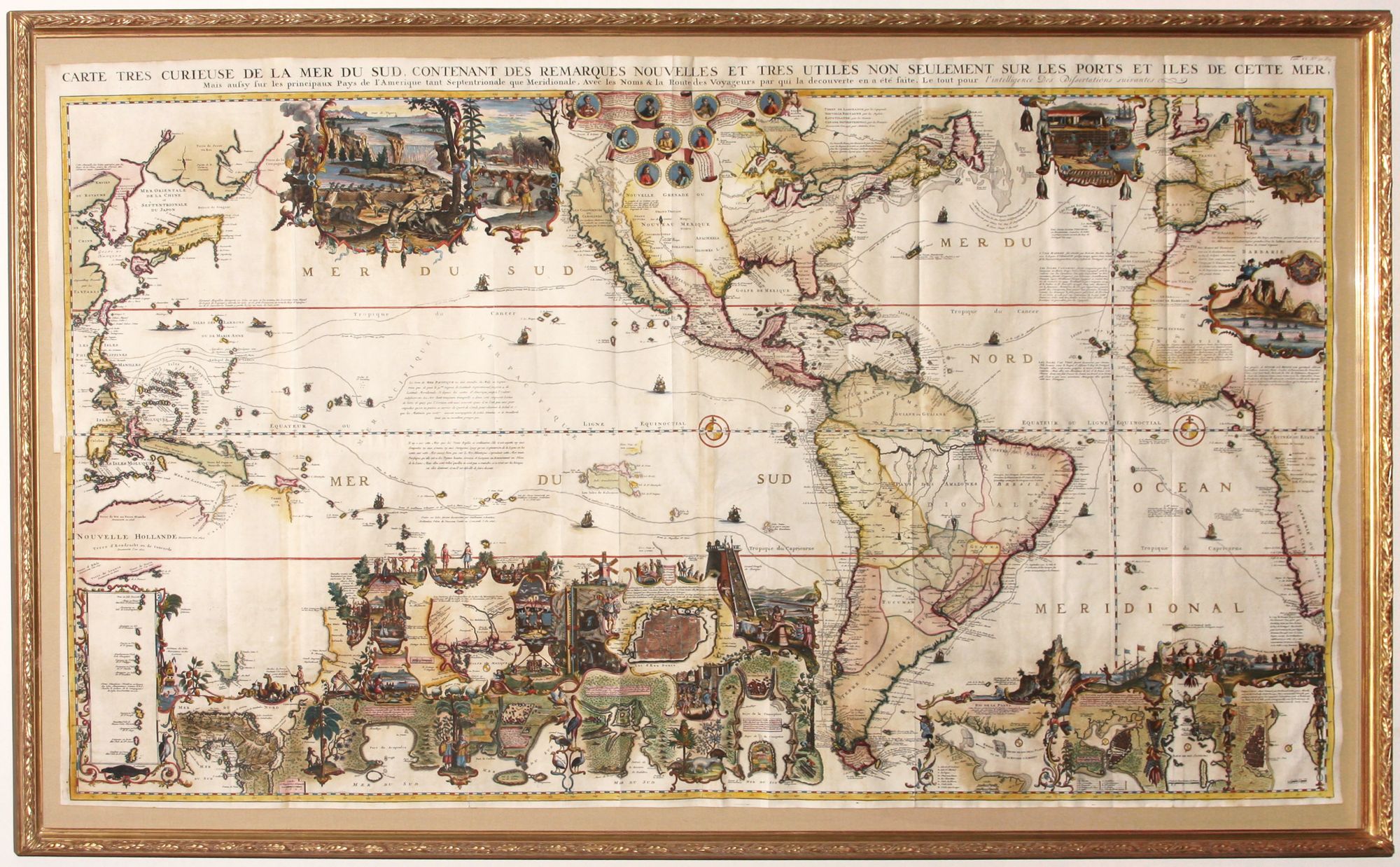
Carte Tres Curieuse de la Mer du Sud . .
31 x 55 inches. Printed on four sheets, joined. Superb, richly layered hand coloring; excellent condition.
A superb, richly hand-colored example of a wall map of extraordinary intricacy and detail: "one of the most decorative maps of North America of the 18th century" (Tooley). Its elaborate illustrations provide a panorama of the Discovery Period, colorfully depicting the mores, rituals and practices of indigenous peoples thought to be exotic by Europeans at the time. Also illustrated are historic episodes, New World flora and fauna, and portraits of the great discoverers. Two of the more prominent illustrations depict an uncommonly industrious and human-like beaver colony and the sun drying of cod fish in Newfoundland. Both of these commodities were mainstays of the early economy of North America. The map was engraved by Bernard Picart.
The map with its lush imagery may also be viewed as the mapmaker’s attempt to stimulate interest in pan-Pacific trade. The map’s presentation of an undersized Pacific Ocean, with voyage tracks showing direct and easy crossings, certainly makes the ocean appear less than forbidding. The map also includes many of the lands of the eastern Pacific Rim, making clear that vast territories would be accessible via Pacific voyages. And the hyper-rich imagery also suggests the potential rewards of such an effort. The map was also one of the most elaborate examples of pictorial geography that was popular at the time. In the first half of the 18th century, there were many works published with richly illustrated maps in order to convey history and geography together.
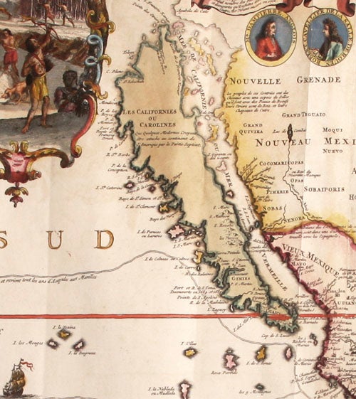
Although California is still shown as an island on the map, it is done so with some uncertainty. (California began to be depicted as an island in the 1620’s, but by the time this map appeared, the myth was beginning to wane.) A notation states that "moderns" believe it to be part of the mainland, and the island is engraved with a fainter hence less definitive line.
A recent article in the Imcos Journal by Jan W. van Waning entitled “Chatelain’s Atlas Historique New evidence of its authorship” (Spring 2010, No. 120, pp. 7-15) contends that the compiler of the seven-volume work, in which this map was published, was Zacharie Chatelain rather than the usually cited Henry Abraham.
* Schwartz/Ehrenberg, pp. 146-47, pl. 85; Tooley, Mapping of America, p. 130; Leighly, California as an Island, pl. xx; Mclaughlin 190.
Sold