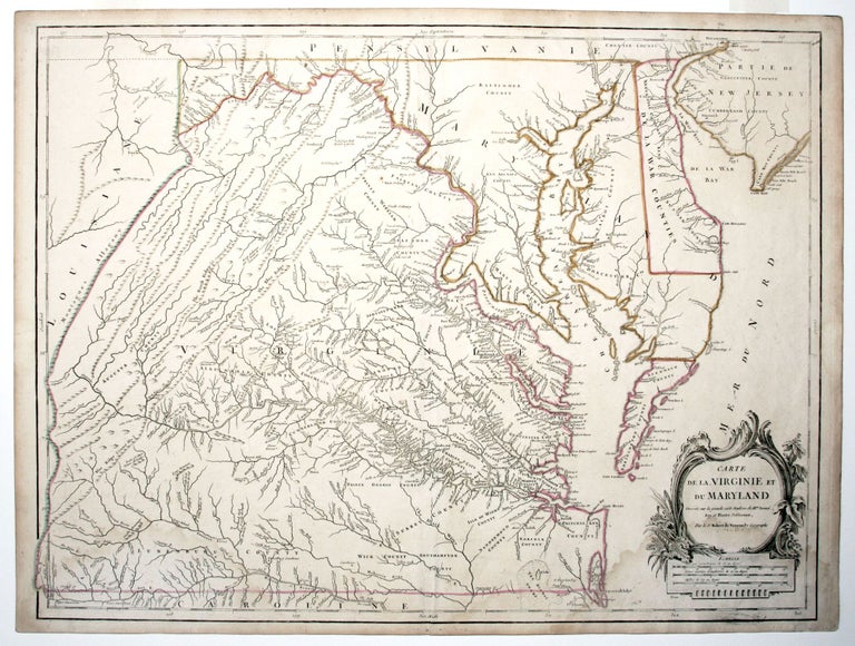
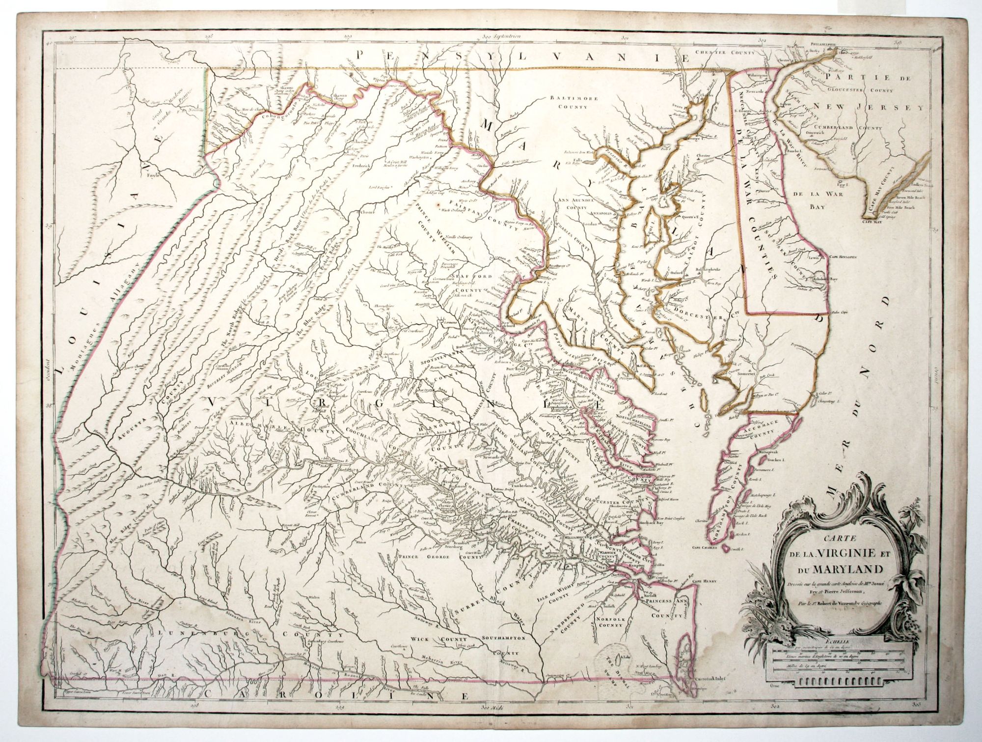
Carte de la Virginie et du Maryland . .
19 x 25 inches. Original outline color; some water staining, else excellent condition.
French edition of the definitive colonial map of Virginia and Maryland, which “became the preeminent map of Virginia for the remainder of the eighteenth century” (Stephenson & McKee). It appeared just a few years after the original edition, which is believed to have been published between 1753 and 1754. Moreover, most surviving copies of the English edition were printed in the 1770's and therefore postdate this French edition.
The map had semi-official status, as it was the result of orders from the Board of Trade to colonial governors to prepare maps of their provinces. Another impetus for the map was the great westward push of settlement toward the Valley of Virginia. The map "shows distances between Virginia cities... It is also the first printed map to show parallel ridges and valleys in the Appalachian Mountain range in their correct direction" -- Schwartz/Ehrenberg, The Mapping of America, pp. 158-59.
Peter Jefferson was the father of the third president and Surveyor of Albemarle County.
* cf. Stephenson & McKee, Virginia in Maps, Map II-21A-D; Pedley 470, state 5.
Sold