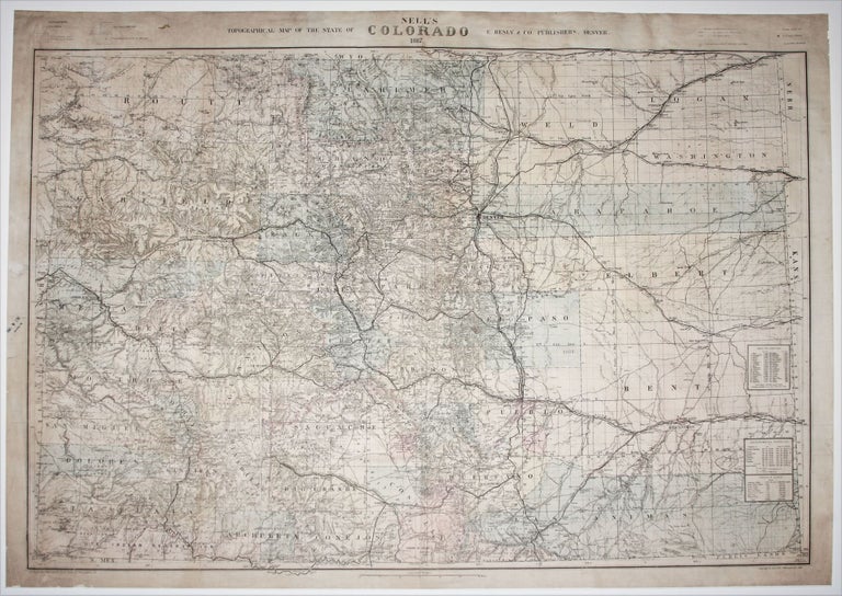
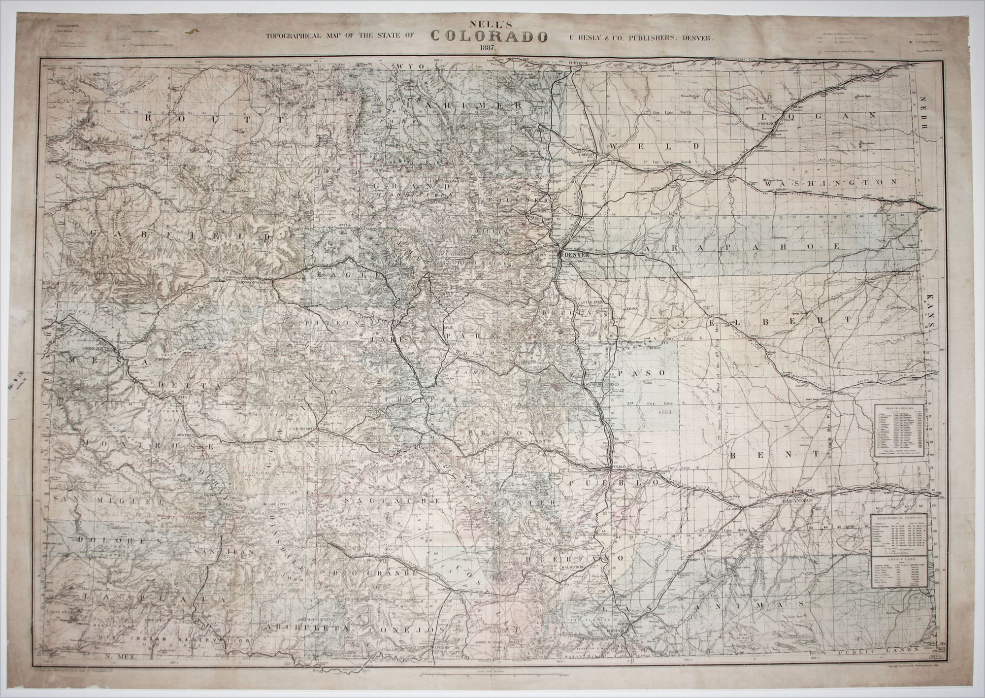
Nell’s Togographical Map of the State of Colorado….
30 ½ x 39 ¾ inches, Lithograph with original hand color. Some wear along margins, reinforced along vertical fold, mounted on rice, overall very good condition with map area unaffected.
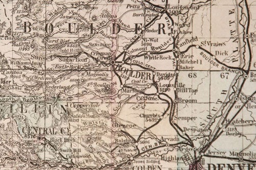
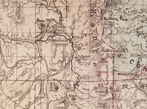
Separately published. The scarce first edition of Nell’s largest and most detailed map of Colorado, it was certainly the most complete map of the state to appear after statehood (1876). A measure of its quality is that it remained in publication for nearly 20 years with an edition as late as 1906. This third and largest of Nell’s maps of Colorado is remarkable for both the sheer amount of detail it contains as well its painstaking accuracy. Particularly noteworthy are the detailed depiction of the state’s mountainous topography and the noting of the elevations of countless peaks, including many in what are today well known ski resort areas.
Counties are differentiated by colors on the map. Wagon roads, trails, and railroads, both existing and proposed, are shown. Additionally, the map includes township grids, U.S. land offices, Land Office districts, counties, Native American reservations, military reservations and posts, land grants and mineral deposits. Includes explanations and tables: "Area of counties," "Arable land," and "Astronomical positions." Relief shown by hachures, spot heights, and contours. Scale [1:633,600].
Louis Nell was part of the Wheeler survey crew, which performed the field surveys for much of the earliest mapping of Far West between 1871 and 1879, including in some of the most challenging mountain and desert areas. Nell then married and settled in Colorado and produced several maps of the state.
* Rumsey 664, 3039, 665 (three editions—1889, 1895, 1905).
Sold