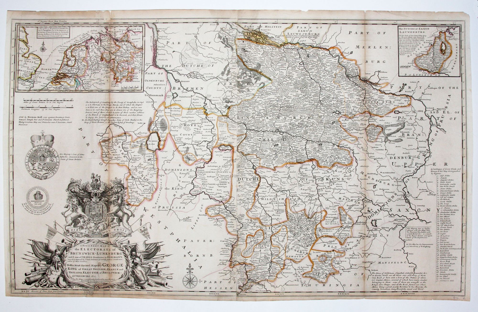
A New & Exact Map of the Electorate of Brunswick-Lunenburg and he rest of ye Kings Dominions in Germany.
24 x 39 5/8 inches. Original outline color; fold reinforcements, restoration to lower part of cartouche with some facsimilization, else very good.
A map dedicated to the English Hanoverian king, George I, of the provinces in Germany, mainly Brunswick and Luneburger, over which he ruled. The English map engraver and publisher, Herman Moll, himself originally from Germany, is at his florid best in his dedication to the king and in displaying familiarity with various aspects of the monarch, such as his coat of arms prior to ascension. Moll’s depiction of the royal arms and the various martial regalia surrounding the cartouche also display his considerable engraving talents at their best. At top center is the estuarial northern part of the Elbe River facing Hamburg, while Hanover appears appropriately pretty much in the center of the map. An early issue of the map listing only Philip Overton as a partner.
Sold