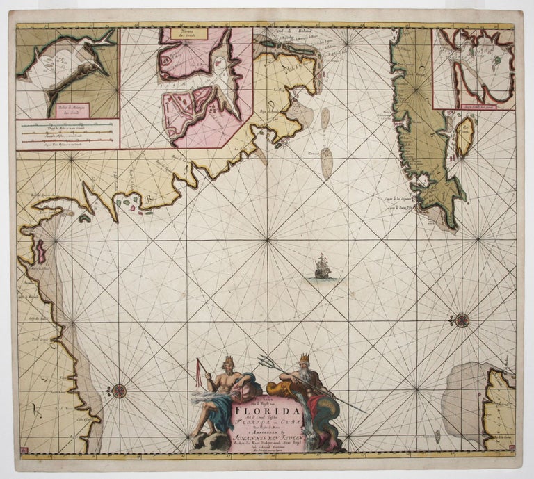
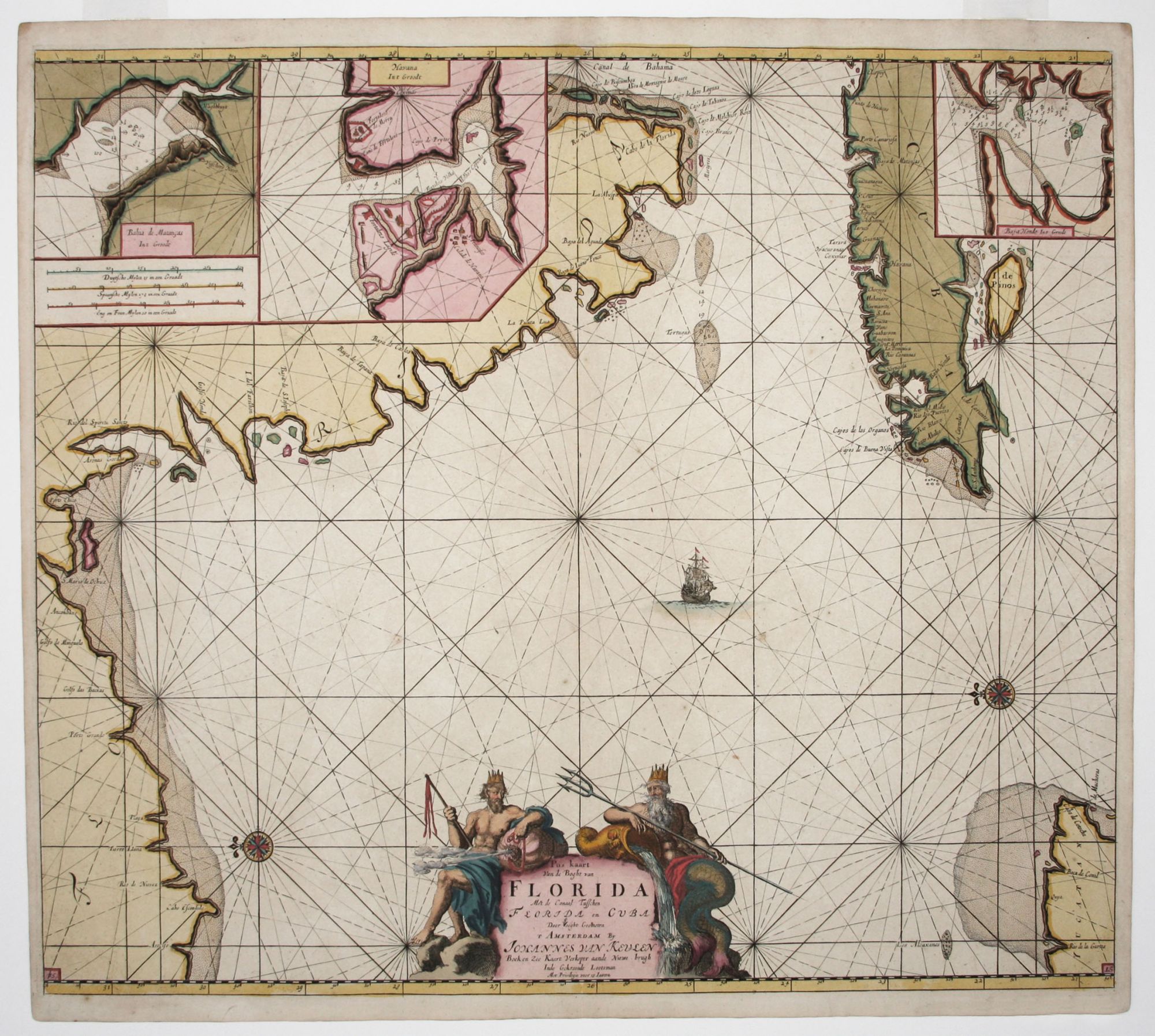
Pas Kaart Van de Boght van Florida.
20 x 23 inches, Fine original color; fine condition on heavy paper.
A mint, beautifully colored example of “the first sea chart of the eastern portion of the Gulf of Mexico detailing the west coast of Florida” (Burden). The somewhat eccentrically formatted work is oriented with north to the left and includes parts of the south and west coasts of Florida, the Bahamas, and the western two-thirds of Cuba. Moreover, within these landmasses are three insets containing, respectively, harbor charts of Tampa Bay, Havana and Matanzas. Virtually all place names are in Spanish, suggesting that the sources of the chart were unprinted Spanish rutters or manuscript maps.
Martin and Martin describe the Van Keulen sea atlas as a "work [that] was immediately recognized as superior to anything else on the market and enjoyed a considerable reputation for accuracy and detail." The Van Keulen firm had unprecedented longevity and was in operation for over two centuries from 1678 to 1885.
* Burden 591, state 3; Koeman, IV, no. 15, p. 380; Martin & Martin, pp. 84-5.
Sold