![Item #10001 A General Map of the Middle British Colonies… [Second title above top border: The Seat of War in the Middle British Colonies…]. L./ SAYER EVANS, BENNETT.](https://martayanlan.cdn.bibliopolis.com/pictures/10001.jpg?width=768&height=1000&fit=bounds&auto=webp&v=1530804247)
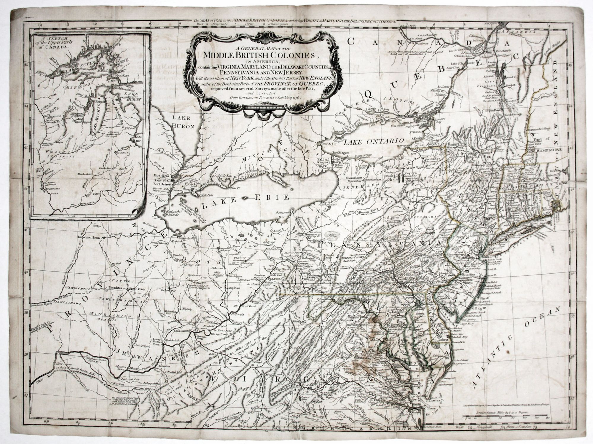
A General Map of the Middle British Colonies… [Second title above top border: The Seat of War in the Middle British Colonies…].
19 x 26 inches, Original outline color; reinforced fold separation & wear, slight losses due to abrasion, mended split into surface; nice, dark printing impression; overall very good, especially for a map originally issued folded. A scarce, handsomely engraved edition of the great Evans map intended for use by British officers serving in the American Revolution. This edition appeared as both a separate and in the American Military Pocket Atlas, styled the “Holster Atlas,” as it was intended to provide a geographic overview for British officers being shipped off to battle the rebellious colonists. This was a new state, second issue, of the often-used Kitchin-Jefferys-Sayer plate but with significant changes (“…so strangely altered as to be almost unrecognizable,”). An important improvement in this state was the expansion of the inset at upper left to contain all of the Great Lakes not already shown on the map proper. The shapes of Lake Ontario and Erie have also been updated, and the map was expanded to include some of Canada north of the lakes. Many of the other changes, especially in the Ohio area, reintroduced Evans’ original delineations that were distorted in the earlier states of the present plate. Forts are shown in abundance in New York, especially in the Lake Champlain region, and in Pennsylvania. Roads and trails are also shown throughout. Stevens Map XV, see also XIV.
Sold