![Item #10000 A General Map Of The Northern British Colonies In North America.... [Title above top border:] The Seat of War, in the Northern Colonies, R. SAYER, J. BENNETT.](https://martayanlan.cdn.bibliopolis.com/pictures/10000.jpg?width=768&height=1000&fit=bounds&auto=webp&v=1551190017)
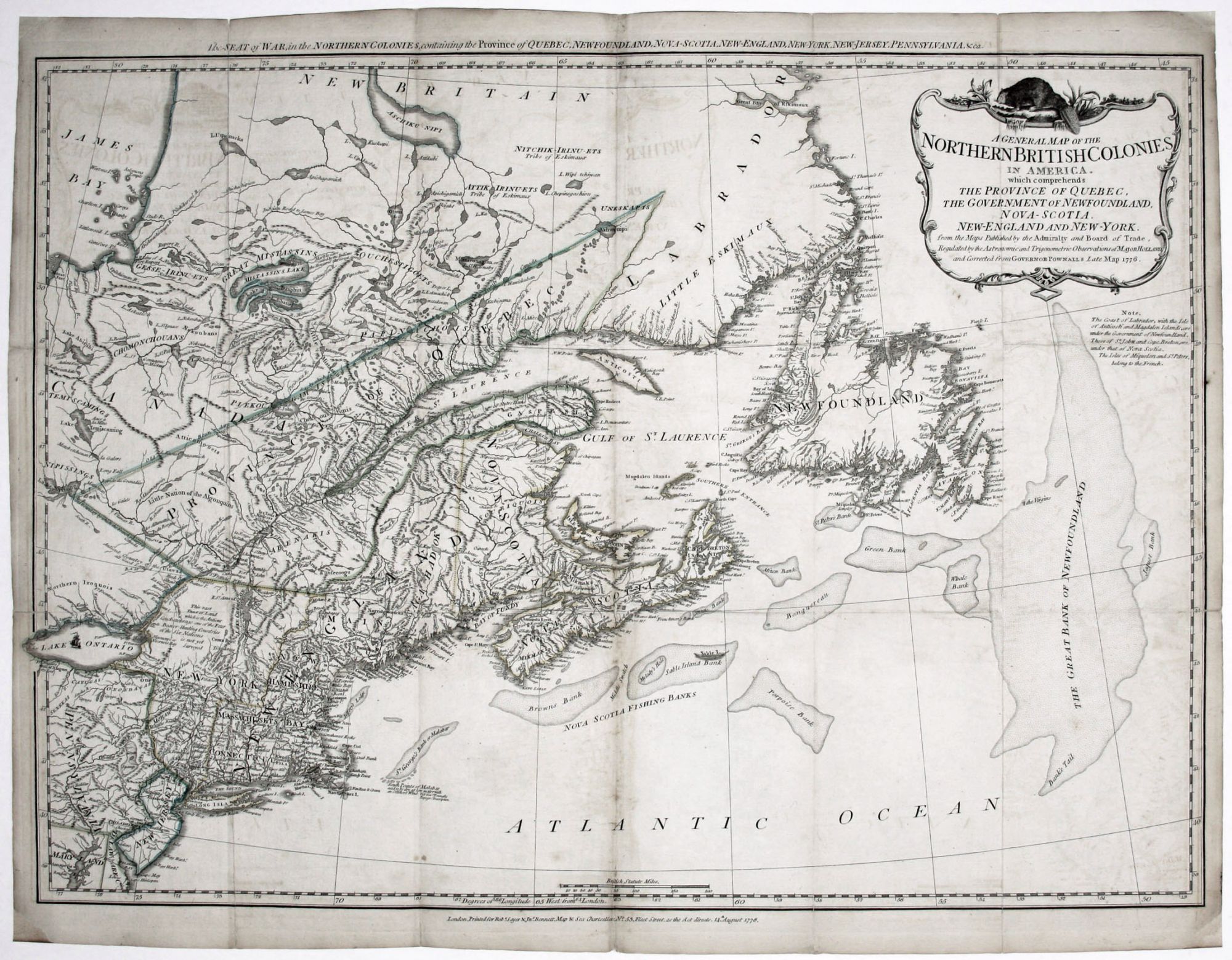
A General Map Of The Northern British Colonies In North America.... [Title above top border:] The Seat of War, in the Northern Colonies,
13 ¾ x 19 ½ inches. Original outline color; some marginal mends, few fold reinforcement & expected offsetting, light staining bottom of centerfold, still overall excellent condition, especially for a folding map.
The scarce first state in an unusually nice example, especially considering it appeared folded in a hand atlas carried by British officers during the American Revolution; it was called The Military Pocket Atlas and was popularly known as "The Holster Atlas." The map provided the best overview of the Northeast available at the time and includes roads throughout the area. It is in general outlines a clear improvement over the four-sheet map of Jefferys/ Mead map of New England, 1755. For the present map, Sayer & Bennett utilized the Pownall/ Evans map of 1776, the surveys of Samuel Holland that were used by DesBarres, and various official works. On the map, New York includes all of present day Vermont, and Dartmouth College is shown. A quite accurately engraved beaver surmounts a handsome cartouche.
* Tooley, R.V. Mapping of America, p. 92, #65a; Nebenzahl, K. Atlas of the American Revolution, pp. 11-13.
Sold