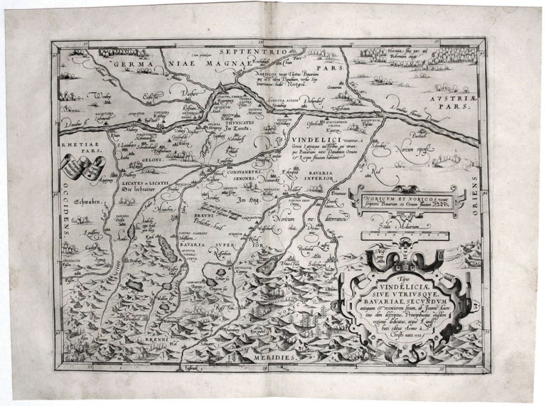
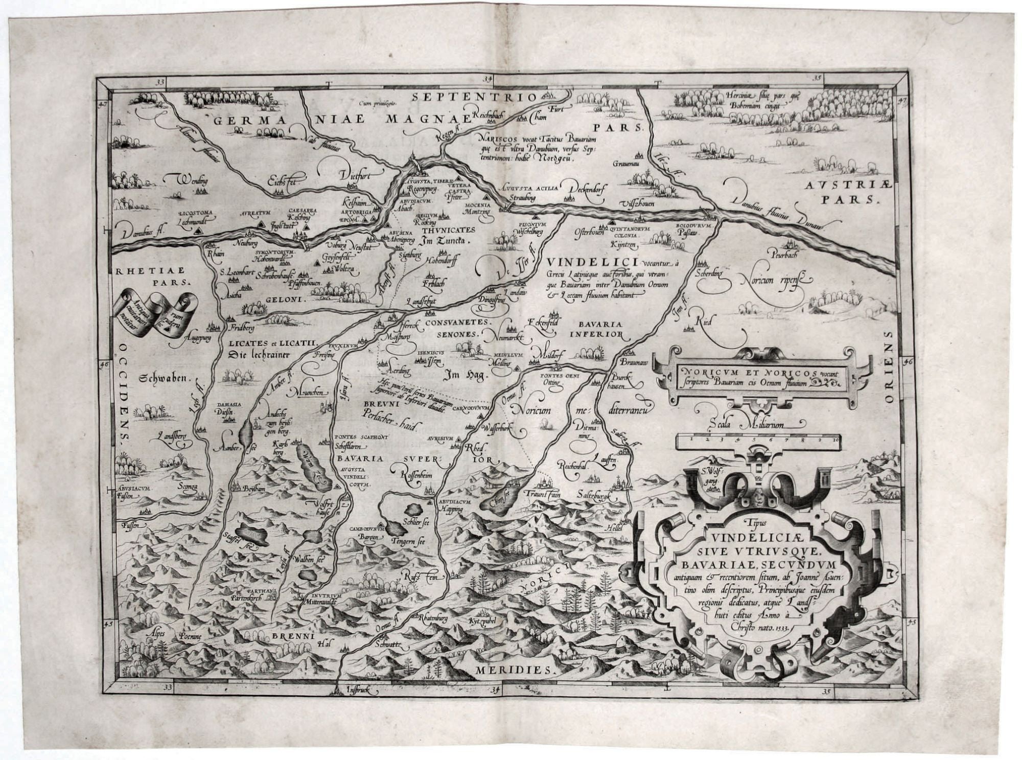
Tipus Vindeliciae Sive utruiusque, Bavariae, Secundum….
13 x 17 inches. Light discoloration top centerfold, else excellent. A most attractive map of southern Bavaria, from the very first edition of the first modern atlas. The map focuses on the region just north of the Bavarian Alps from Augsburg to Salzburg, along the dividing line between upper and lower Bavaria. In addition to indicating the positions of modern cities and towns, the map names and marks the positions of the ruins of ancient cities. The youth of the copperplate results in an unusually sharp and bolt printing strike, revealing in great clarity this map’s beautiful engraving, and vividly evoking the forests and mountains of the region. Ortelius’ Theatrum Orbis Terrarum was the first modern atlas, and set the standard for the mapping of the world well into the 17th century. Ortelius is notable for his scrupulous citation of sources: In this case, he has drawn his data from Johannes Aventinus’ history of Bavaria, Annales Bojorum.
* Van den Broecke 109.
Sold