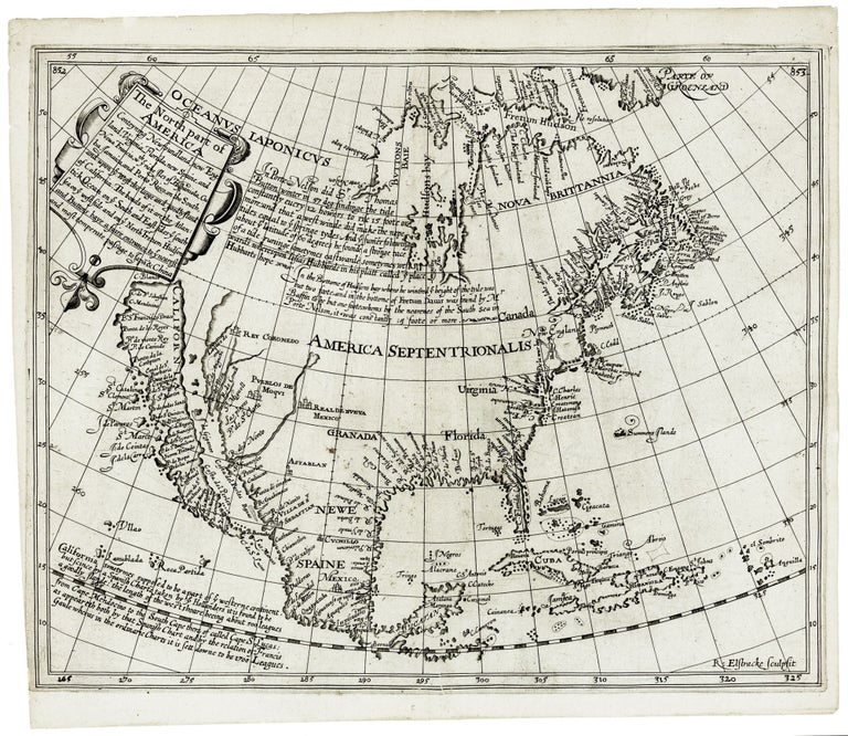
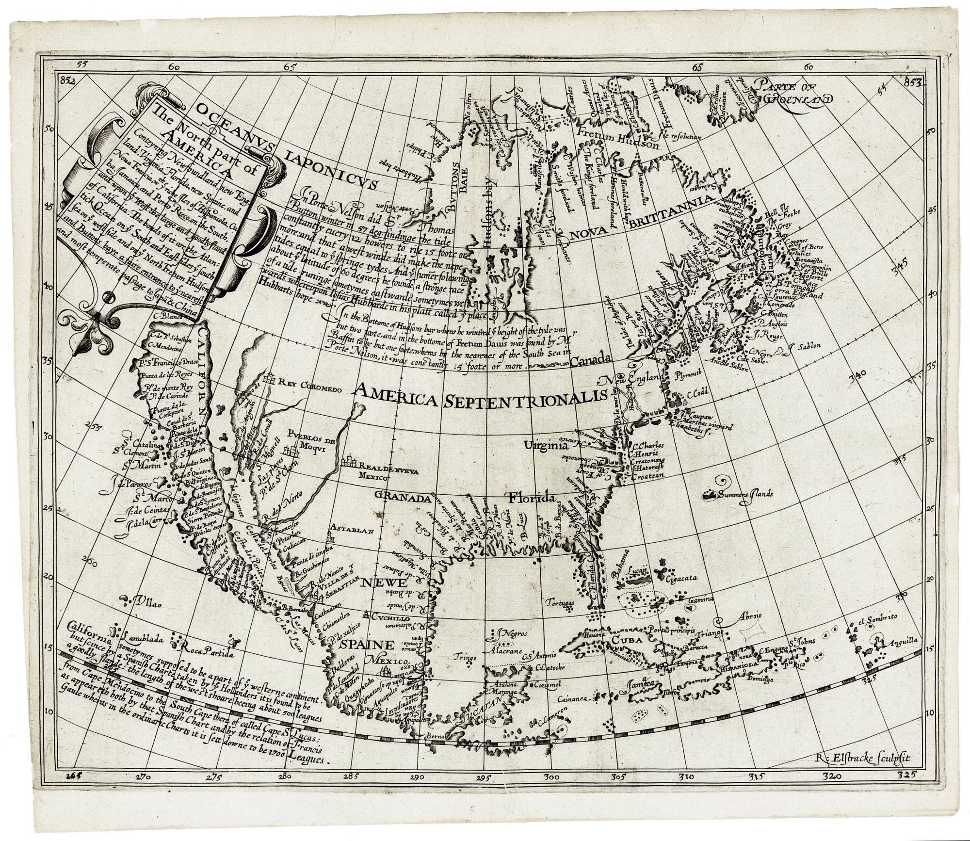
The North part of America . . .
11 3/8 x 14 inches. Very good condition. A very nice example of this rare and fundamentally important map, the earliest English map specifically of North America that is realistically acquirable. The Briggs was also among the very earliest maps to include the key place names associated with early English colonization: Plymouth, New England, Cape Cod, Martha’s Vineyard, Jamestown, Henricus, and “Hudson’s River.” With the exception of Jamestown, these place names appear earlier on just one other map—the Goos map of North America; however, the Goos also does not include Henricus. Even in the west, the Briggs is the first map aside from the Goos to include Sante Fe, Monterey (California), and San Diego. Some scholars even argue that Briggs’ map was actually published as a separate map before the Goos and was the model for the Dutch map. See Burden on this. The Briggs was also the first obtainable map to show California as an island and more than any other map legitimized the myth. On the map is the famous statement that can be considered the initial declaration of the California-as-an-island myth: “California sometymes supposed to be a part of ye westerne continent, but cince by a Spanish Charte taken by ye Hollanders it is found to be goodly ilande: . . .” This historic notation also neatly summarizes the source of the myth with its reference to the Spanish chart of Friar Antonio. Some have argued that the myth was an English ploy to abet their claims to the American west coast. Asserting California to be part of an island rather than the mainland would weaken the Spanish contention that the west coast belonged to them. Regarding the portrayal of California as an island, the Briggs was preceded only by the highly schematic map found on the Herrera title page (1622) and the very rare map of Abraham Goos (1624) of North America. The Briggs map also captures what was perhaps the high water mark of the hope for a Northwest Passage that motivated so many English voyages. Both the map itself and the notations on it express Briggs’ belief, which was widely shared at the time, that there existed an easily navigable seaway through North America to the riches of the east: “Buttons baye [provides] a faire entrance to ye nearest and most temperate passage to Japan & China.” McLaughlin 2; Burden 214; Tooley, Mapping of America, no. 1, p. 112; Leighly 4; Fite & Freeman no. 35; Tooley et al, Landmarks of Mapmaking, p. 215; Cumming et al, Discovery of North America, p. 113.
Price: $16,000.00