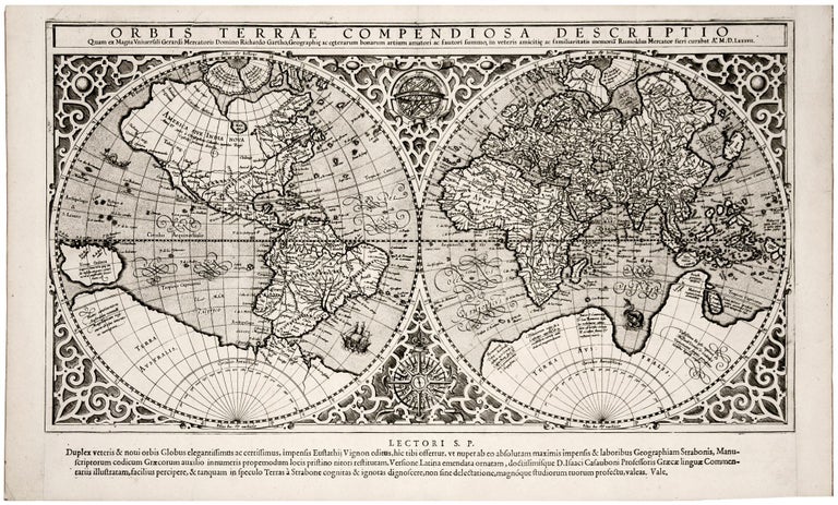
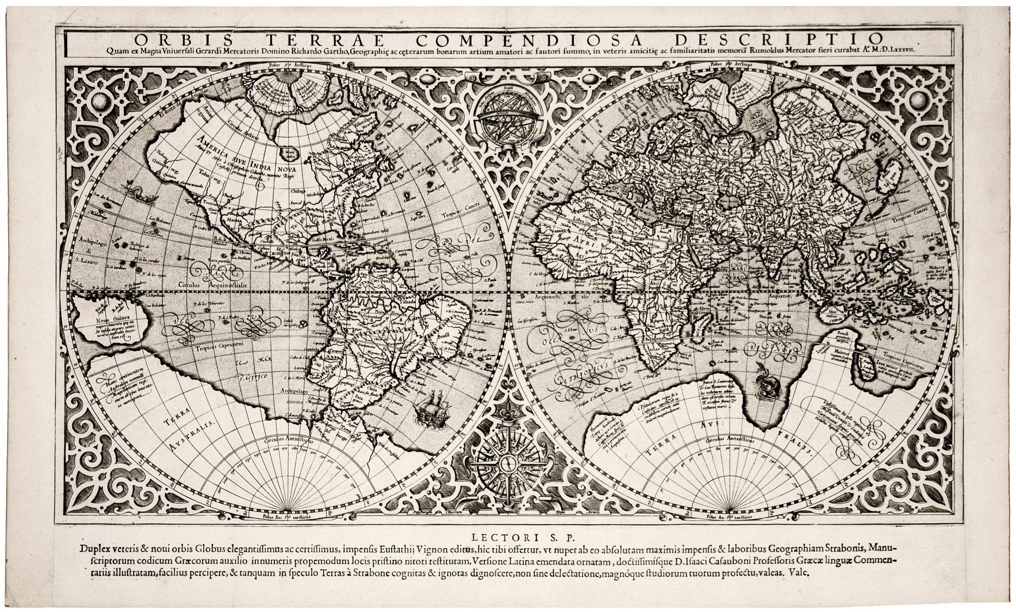
Orbis Terrae Compendiosa Descriptio.
11 ¼ x 20 ½ inches, Margins extended with virtually no loss, else excellent with a bold, sharp strike. A very attractive example of the true first issue of Mercator’s world map, produced to illustrate Casaubon’s edition of Strabo’s geography of 1587 – the only issue of this map printed prior to Mercator’s death in 1594. It is the only acquirable modern world map directly connected to Mercator. His two other world maps of 1538 and 1569 are unapproachable rarities, and the world maps that appeared in his editions of Ptolemy depict ancient geographical knowledge. Described by Shirley as “a model of clarity and neatness,” this map was a reduction of Mercator’s 1569 wall map of the world (known in three surviving examples) by his son, Rumold. However, the present map was recast in a double-hemisphere format that did not employ the projection. It is not clear why the Mercator Projection was not used on this map, while the geographical delineations of the earlier map were. Perhaps because the Mercator Projection was such a recent innovation that was based on very complex mathematics, converting its use from a very large to a much smaller map may have been beyond the skills of the master’s son. Ironically, despite this map’s high geographic merit for its day, it was an inaccuracy on it that arguably proved to be its most influential feature. Mercator chose to depict a quite broad water passage across the northern reaches of the Americas, Asia and Europe. The great regard accorded Mercator would encourage European promoters of voyages of exploration to sponsor efforts to find the Northwest and Northeast Passages depicted on this map. This Strabo edition – best identified by the single broad column of three lines of text at the bottom – preceded by eight years its appearance in the first issue of the Mercator atlas in 1595, published year after Gerard Mercator’s death; the map would be a mainstay of that atlas until 1630.
* Shirley 157.
Sold