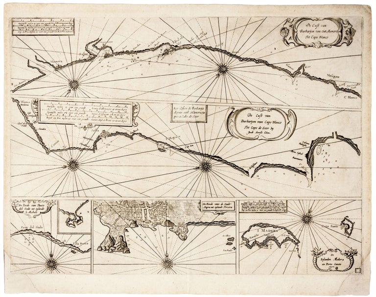
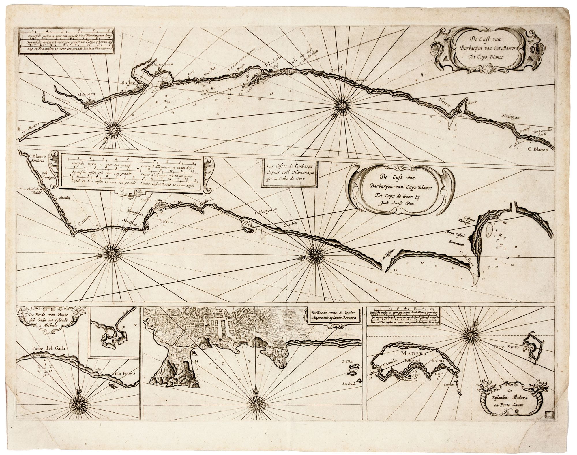
De Cust van Barbarijen van Out Mamora Tot Capo Blanco/ De Cust van Barbarijen van Capo Blanco Tot Capo de Geer by Jacob Aertsz Colom/ De Reede van Punte del Gada int eylandt S. Michels/ De Reede voor de Stadt Angra int eylandt Torcera/ De Eylanden Madera en Porto Santo….
15 ¼ x 20 ¾ inches, Lower corners restored with manuscript replacement of some border; good. One of the earliest charts of the Barbary Coast, Madera and the key Atlantic stepping stones of the Azores to appear in a Dutch nautical atlas. The sheet includes two charts of the coast of Morocco, a harbor chart of Punto del Gada, and a plan and chart of Angra. A further inset chart depicts Madera and Porto Santo, themselves stepping stones to the Azores. Koeman describes Colom’s work as “one of the most important atlases in the well known category of Dutch sea-atlases.” It was the first sea atlas produced in the Netherlands of the entire world and to contain charts of a uniform design. Colom’s charts differ markedly from other such works of the day both in content and in their considerably larger size. One reason for the difference was that Colom adopted Portuguese and Spanish charts as sources. “It marked the first time that such charts were published as atlas sheets. Formerly, their circulation was far more restricted by their being printed on separate sheets, often vellum or copied in manuscript” (Koeman). Colom’s atlas appeared in only three editions and is particularly rare on the market today. This may be explained by the fact that unlike many later Dutch sea atlases, which were intended more for the virtual sailing of the armchair voyager, Colom’s charts were actually used at sea.
* Koeman J. Col 7 (41); J. Col 6A (32).
Sold