
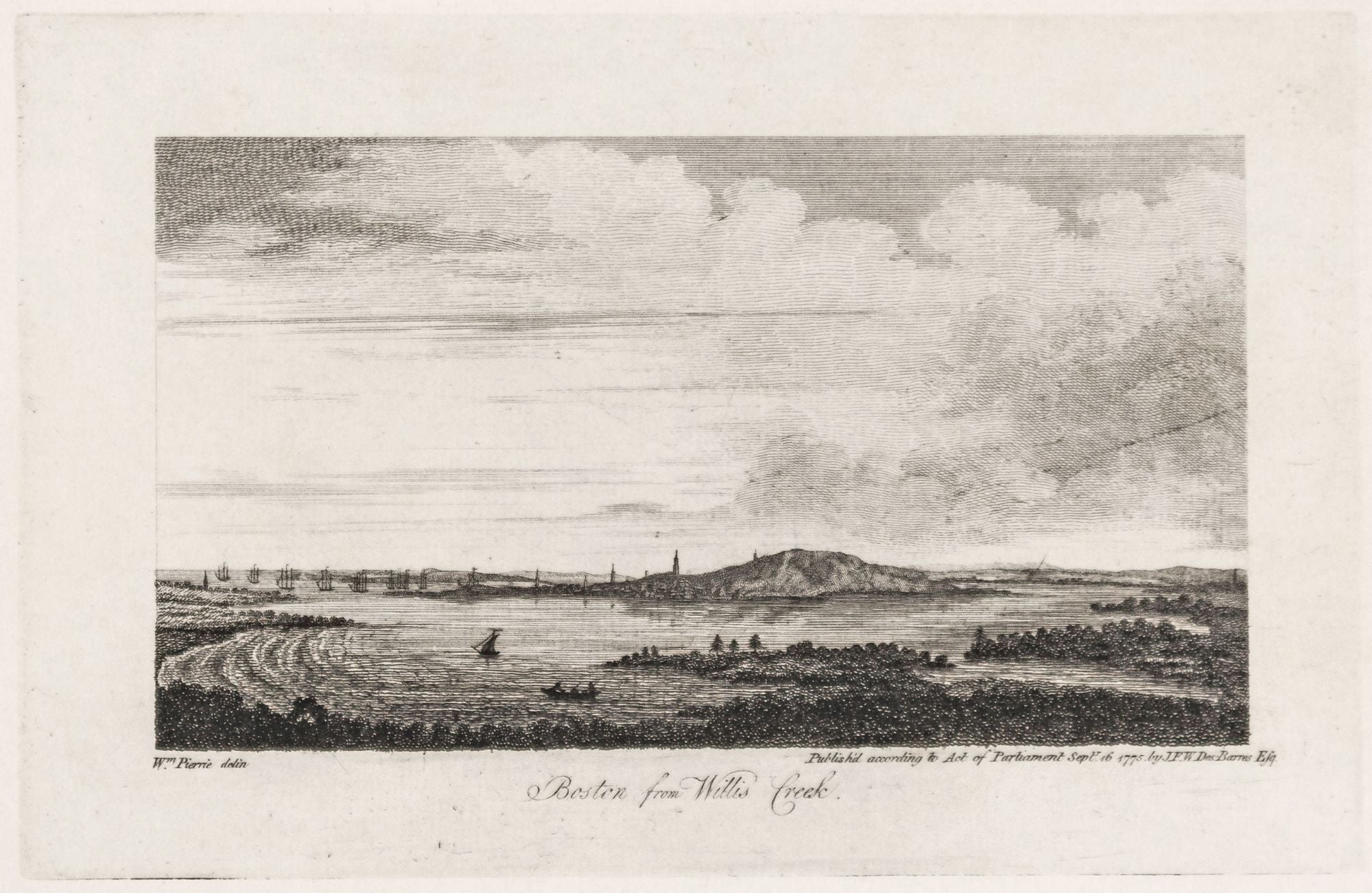
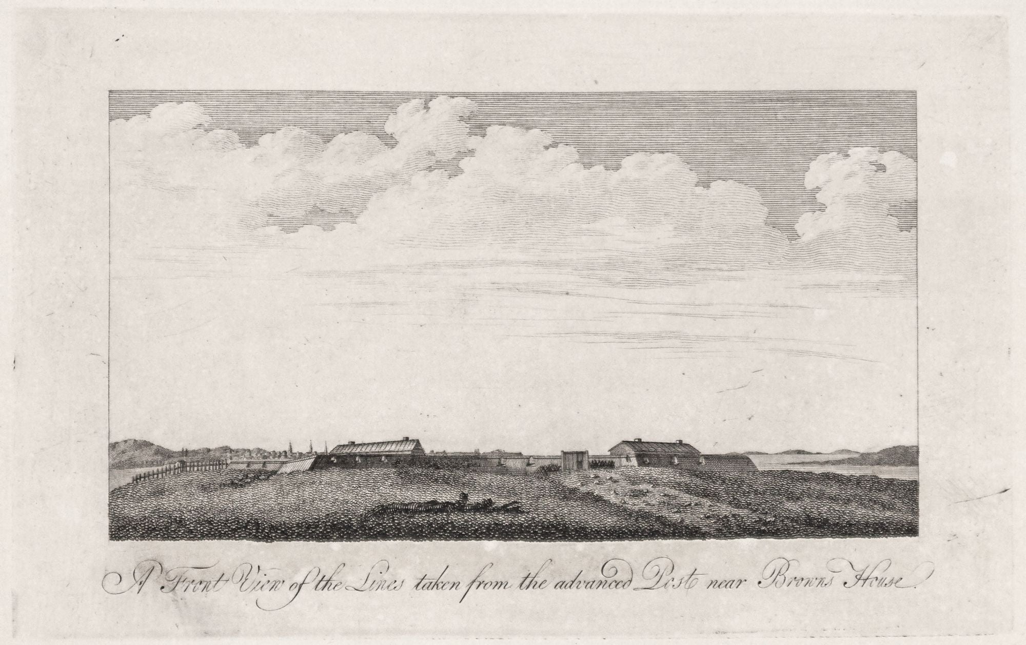
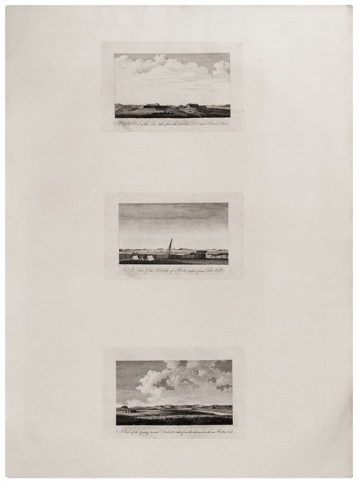
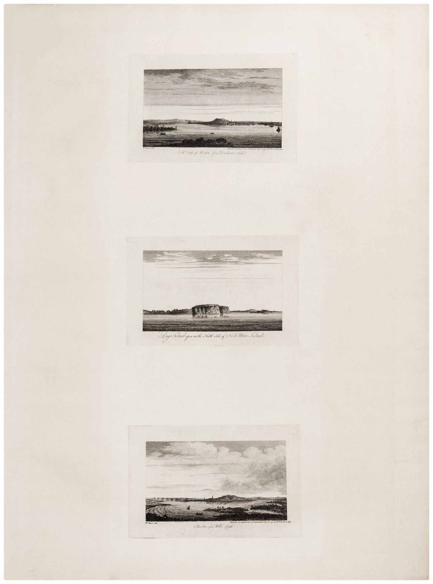
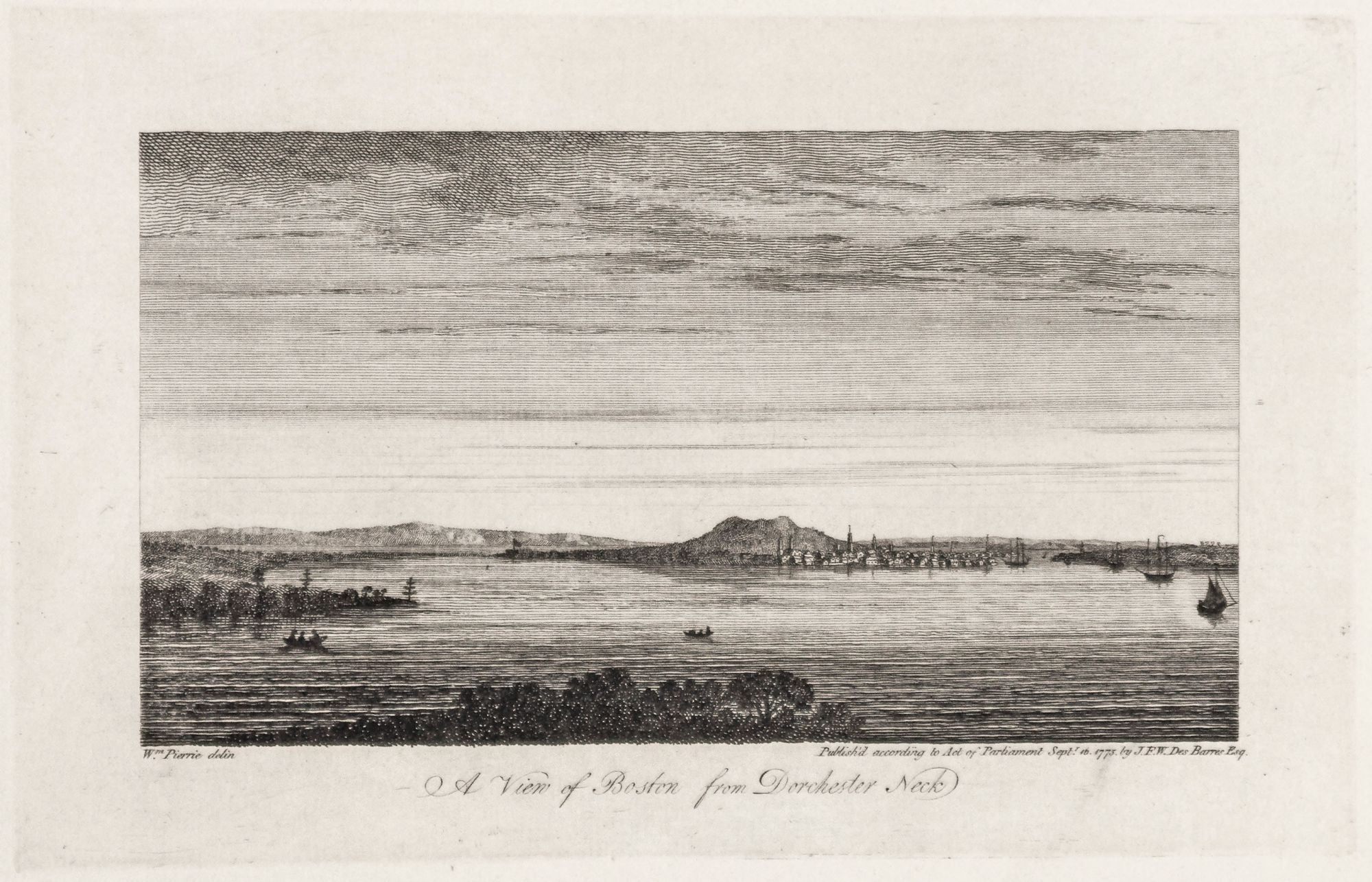
1. A View of Boston from Dorchester Neck. 2. Long Island . . . 3. Boston from Willis Creek. 4. A Front View of the Lines taken from the advanced Post near Browns House. 5. A View of the Harbour of Boston taken from Fort Hill. 6. A View of the Country towards Dorchester, taken from the advanced works on Boston Neck.
Two sheets, each 33 ½ x 25 inches; three engraved & etched views on each; each view measuring approx. 5 x 8 ½ inches. Fine condition. The complete set of six views (on two sheets), all relating to Boston; very rarely seen complete. These fine engravings of various vistas of Boston are important records of the area prior to as well as just after the beginning of the Revolution. Three of views show Boston itself, from various vantage points. They are based on British officers' reconnaissance sketches, some showing military emplacements. It is likely that the original sketches on which the views were based were drawn at quite different time periods. (The publication date given above appears below two of the views; all were evidently published at the same time.) Two of the views give “Wm. Pierrie” as the original artist. According to Deak, Pierrie or Pierie was a British artillery officer who drew a series of views of Boston in 1773. However, the remaining four views do not give an artist’s name. Some or all of these appear to have been drawn after hostilities had begun, as no. 4 refers to entrenched “Lines,” and no. 6 shows soldiers in a redoubt. These, therefore, are likely from a source other than Pierie. Some of views are also extremely valuable records of Boston’s original topography, which, as Whitehill points out, was “so radically . . . altered in the early nineteenth century that one must turn to early views to get any notion of the triple peaks.” These considerable hills were Boston’s most prominent topographic feature at the time. Whitehill points to one of the views of this series, no. 3 above, which he illustrates, as providing a particularly good view of the triple peaks as seen from Cambridge. Most of the earth of the triple peaks was used for fill to produce Back Bay, with Beacon Hill being the only remnant of the original formation.
* Whitehill, W. M. Boston A Topographical History, p. 6, fig. 2, (no. 3 illus. on dust jacket); cf. Deak, Picturing America, no. 132.
Sold