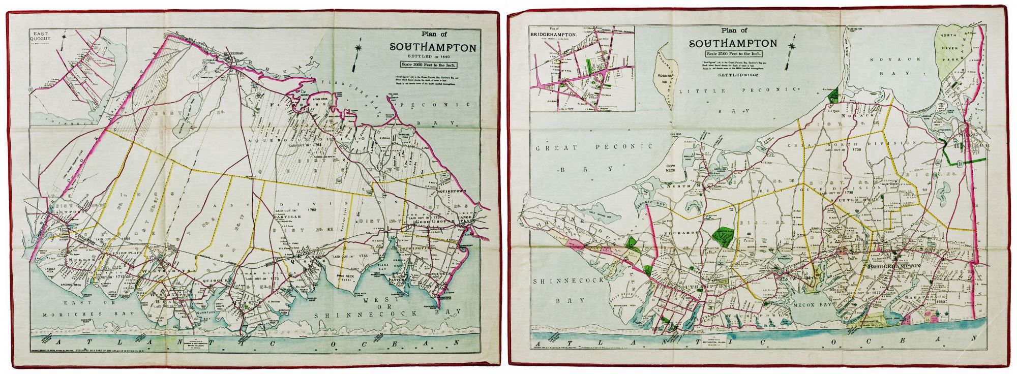
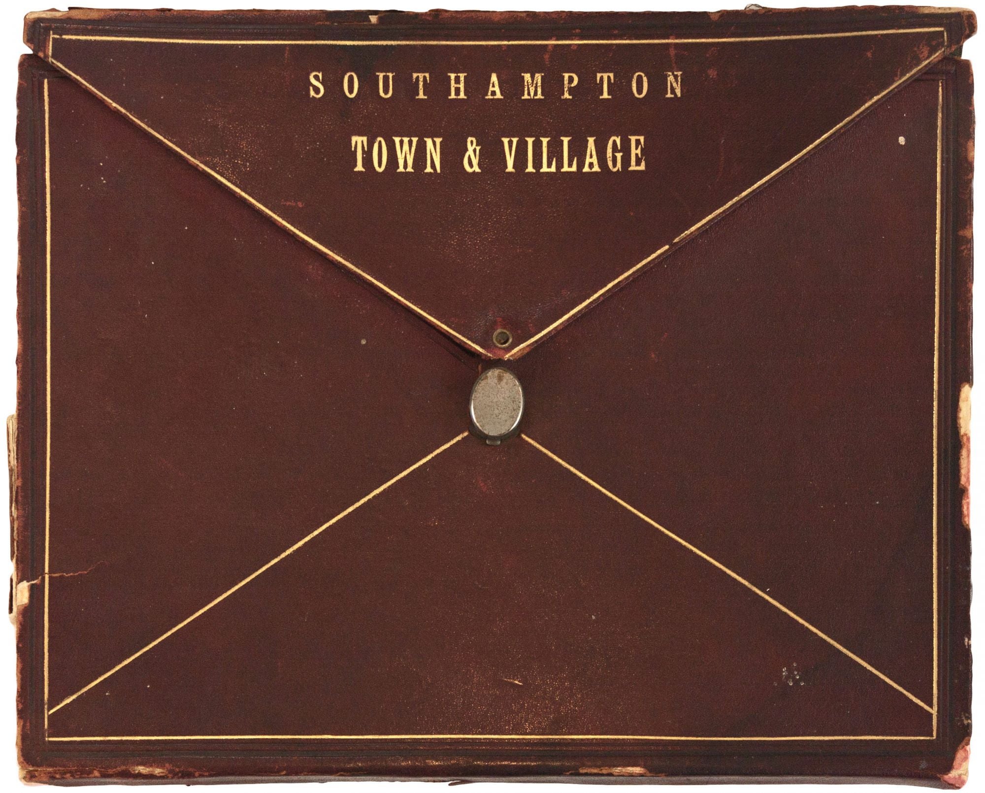
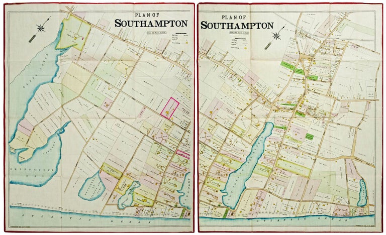
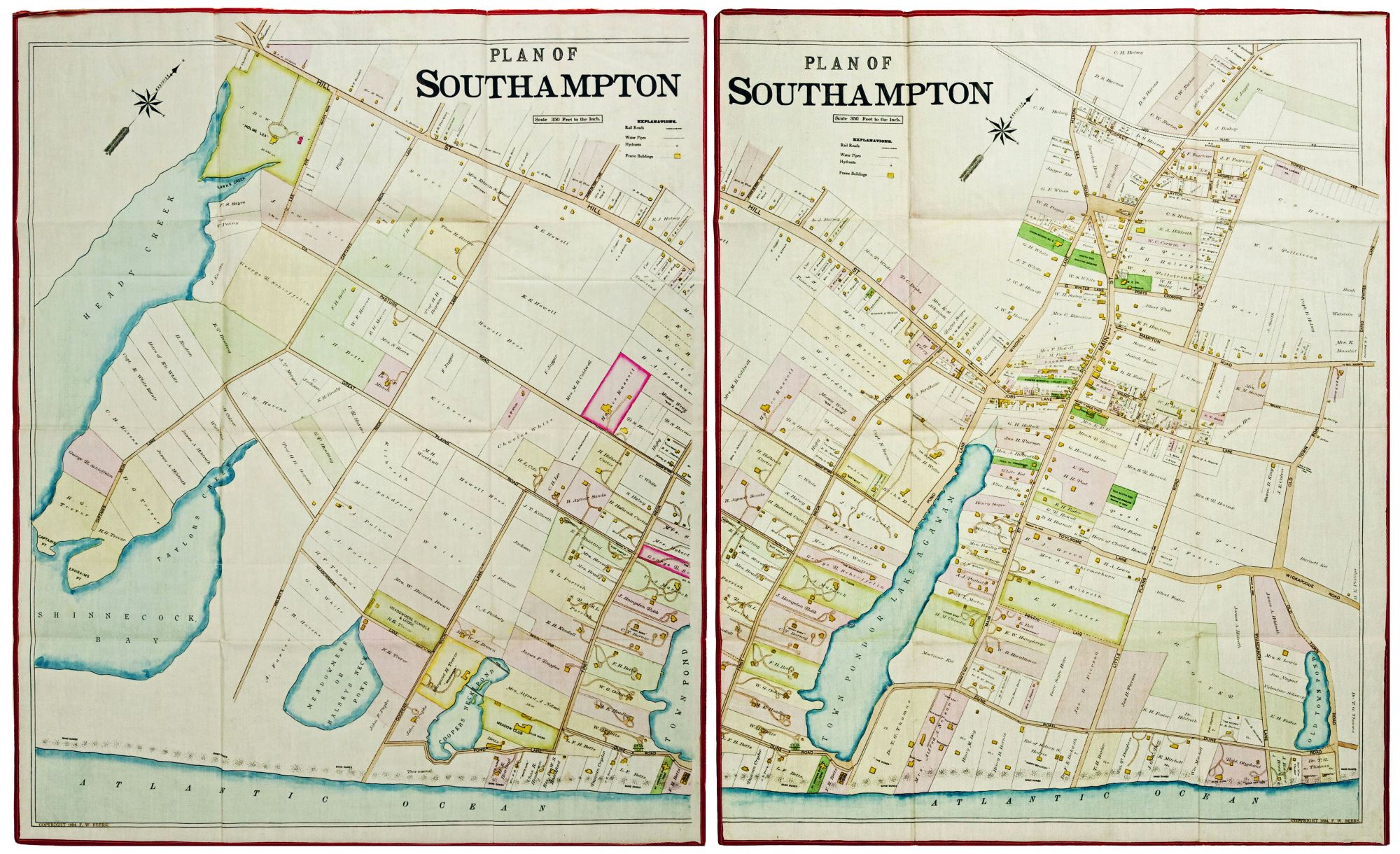
Four Sheets Comprising Two, Double-Sheet Maps, One of Southampton Village & the Other of the South Fork. Each sheet with the title--Plan of Southampton. Two sheets of general map, each @ 20 x 28 inches, two sheets of Southampton map, each @ 27 ½ x 23 inches. Period hand-colored, lithographed, folding maps on silk, edged with red cotton, folding into original case. Case partially restored, maps in fine condition. Extremely rare, separately published set of maps, one of Southampton Village and the other of the major resort communities of Long Island's South Fork--four sheets in total comprising two distinct maps. These vibrantly colored, elegant maps, printed on silk, were no doubt published to mark the incorporation of Southampton Village in 1894, perhaps as a commemorative keepsake. The two-sheet map of Southampton Village, which was not published in Beers' atlas of Long Island of the same year, is an invaluable record of property ownership as well as of structures existing at the time throughout the entire village. Owners' names are provided for all properties. This map makes clear that Southampton was by this time well on it way from being an agricultural community to becoming a summer retreat for the wealthy. Following the practice of their Newport brethren, Southampton's wealthy, as can be seen on the map, took to naming their "cottages," such as Dr. T. G. Thomas' "Sandhurst" and "Bonito," Alfred A. Nelson's "Clovertop" and "Ingleside," and G. E. Harney's "The Arches," to name a few. The plan also indicates burial grounds, various civic and municipal structures, and topographic features. The general map, which is an enlarged and more detailed version of one that appeared in the Beers atlas, includes what are today the South Fork's well-known summer resort communities of Westhampton, Sag Harbor, Quogue, Bridgehampton, Water Mill, Shinnecock Hills and Southampton as well. While this map does not delineate the property lines of individual owners, it does indicate the area's residences along with their owners' names. All of the area's roads and rail lines are also shown. We have found no market records for this set, and OCLC sites only copies of two sheets of the map at the Brooklyn Historical Society.
Sold