Amerique Septentrionale . .
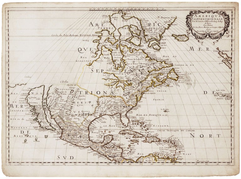
15 x 20 ½ inches. Original outline color; excellent condition. An attractive example of a pivotal map, which inaugurated a new era in the cartography of North America, as dominance in mapmaking turned decidedly in favor of the French. In addition to being one of the earliest obtainable maps to show all five Great Lakes in a recognizable form, this map was also the first to name Lakes Superior and Ontario. It was also the first map to locate Santa Fe and the Apache and Navajo tribes, along with other innovations in the Southwest. This was one of the first maps published in France to depict California as an island. Due to Sanson’s prestige, it would greatly influence acceptance of the myth among French cartographers for several decades.
* Burden 294, state 3; Leighly, pl. VII; Schwartz/ Ehrenberg, pl. 61; McLaughlin 12.
Sold