New Jersey / Railroads.
[Philadelphia, 1828]
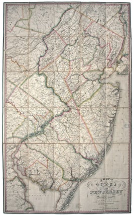
A Map of the State of New Jersey with part of the Adjoining States.
A superb example in the first edition of New Jersey’s first official map, with a distinguished provenance (see below). With this work, “New Jersey mapping had achieved a new high” (Snyder). Rumsey calls the Gordon the “cornerstone map of New Jersey…by far the most accurate map to date.” Scrupulously revised..... More